HOME           /           ABOUT           /           ETSY           /           CONTACT
Showing posts with label vintage postcards. Show all posts

Tuesday, May 5, 2015

Kennywood's Open

Potato Patch fries. The Thunderbolt. Community picnics. Noah's Ark. Pittsburgh's favorite amusement park, Kennywood, has been dazzling visitors for more than 115 years.

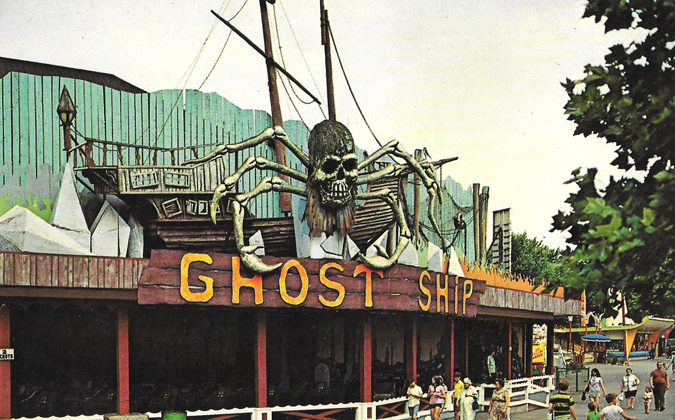
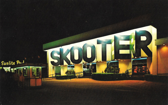
KennywoodGhostShip

KennywoodScooter

Along with most people who grew up in the area, Kennywood is a major source of nostalgia for my family. It was an annual trek growing up. My mom loved the Thunderbolt, a classic wooden coaster that goes off the track with a dip, thanks to the region's hilly terrain, and squeezes your sitting partner around each speeding curve. My dad would ride anything fast or scary, including the Steel Phantom, the park's only steel coaster. (It has since been replaced with Phantom's Revenge.)

During high school, I went there a little too much since I went to picnics and (as a band geek) usually marched in the Fall Festival parade there. Visiting about once a summer is plenty for me to get my Kennywood fill.

I recently found this pair of postcards during a flea market haul. I'm guessing these are from the 1960s, based on some of the outfits patrons are wearing in the Ghost Ship postcard.

It was kinda hard to nail down a time period initially, but after a little research I now know the Ghost Ship operated for only a short time, between 1966 and 1975, when the building it was housed in burnt to the ground from an electrical fire.

There is so much classic charm at Kennywood that's unmatched at most other modern amusement parks. Places like Cedar Point and Six Flags have the thrills, but Kennywood wins on its classics. There's a variety of wooden roller coasters, there's plenty of old rickety rides in the best way like The Whip, the Turtle and Noah's Ark, and delicious foods. The french fries and the square-shaped ice cream cone come to mind. Familiar with the movie Adventureland? Kennywood was the movie's primary set, and was a huge reason why I watched that movie on heavy rotation post-college.

The biggest downfall to the park is there's little room to physically expand, so each time the park announces a new ride, it usually means another ride has to be removed.

The Pitt Fall, one of my longtime favorite rides, fell victim to that a few years ago, and was removed and sold to another park in 2011. Mark's favorite ride at Kennywood, The Turnpike, met the same fate a year or two before the Pitt Fall. (However, park officials said at the time of removal they would likely revive The Turnpike at some point at a new location. That hasn't happened yet, to my knowledge.)

Other favorites of mine are still in existence: the wooden coasters, especially the Racer, the Log Jammer and the swings, which is perfect after a wet ride to dry off. Technically I don't think it's a ride, but I've done the Skycoaster a few times over the years, too.

And if you're a native, you know that the phrase "Kennywood's Open" has more than one meaning. ;) I once, in mid-winter, had a long, awkward conversation in elementary school about whether Kennywood was actually open. A few minutes went by until I realized my classmate was trying to tell me my fly was down. Haha.

The park is now open on weekends, and then opens full-time for summer beginning next weekend. Anyone have favorite Kennywood memories?

Tuesday, April 7, 2015

From Pittsburgh to Philly on the Lincoln Highway

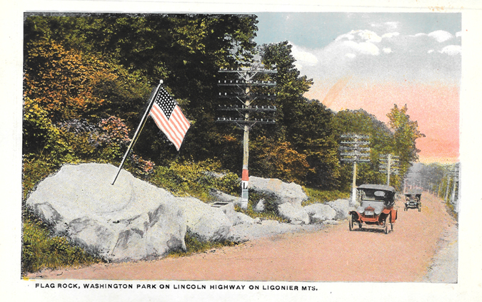
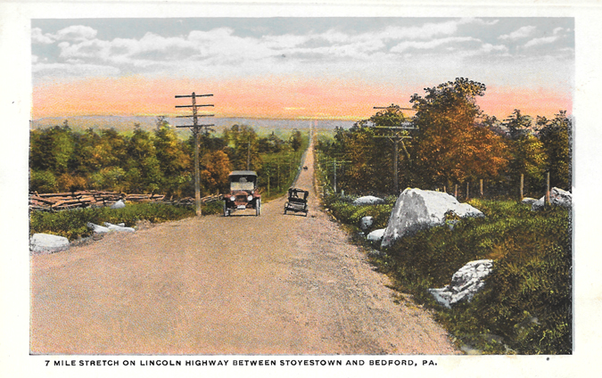
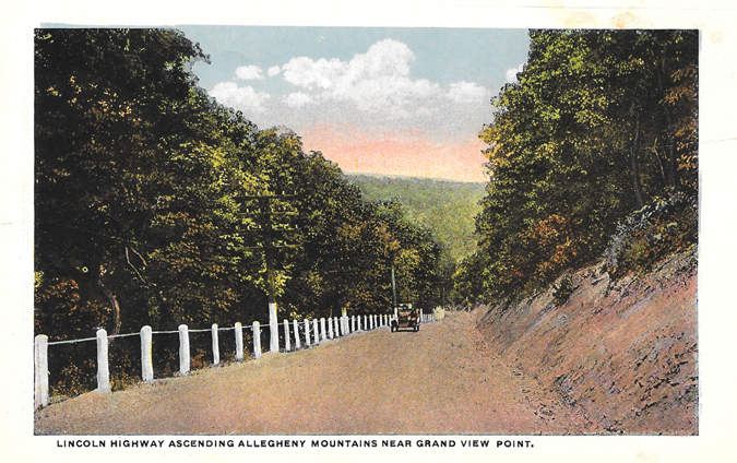
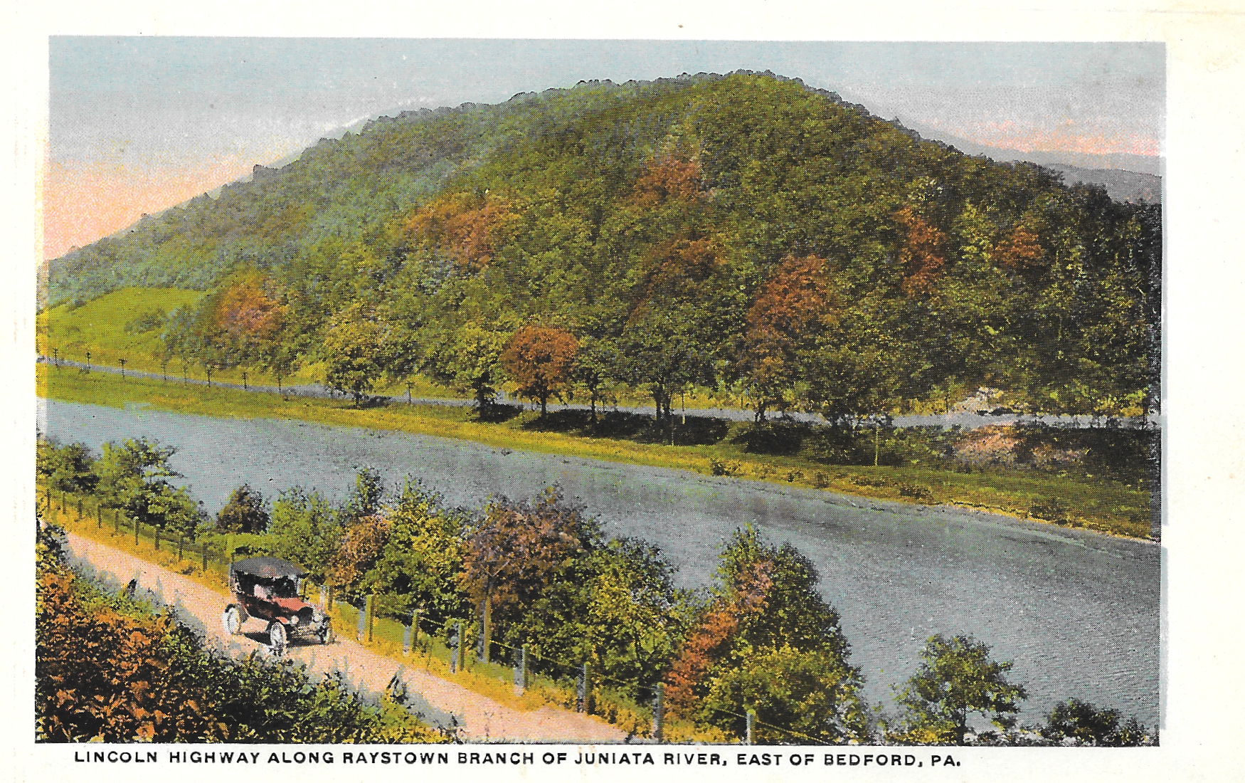
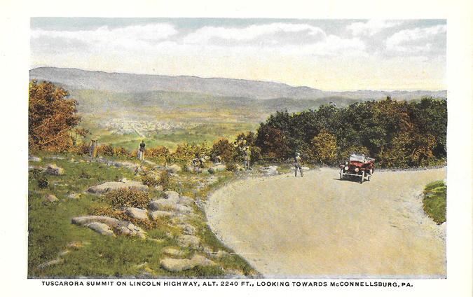
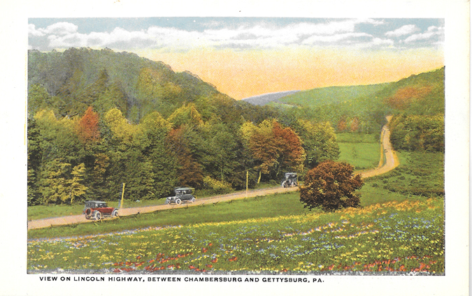
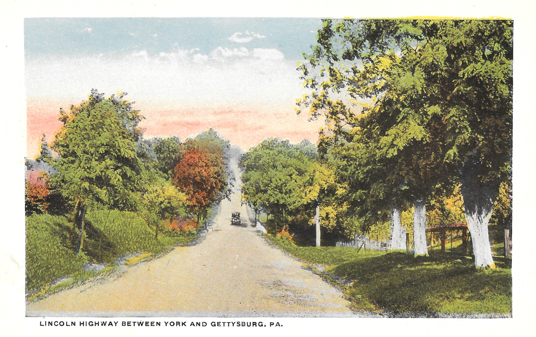
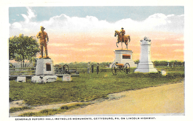
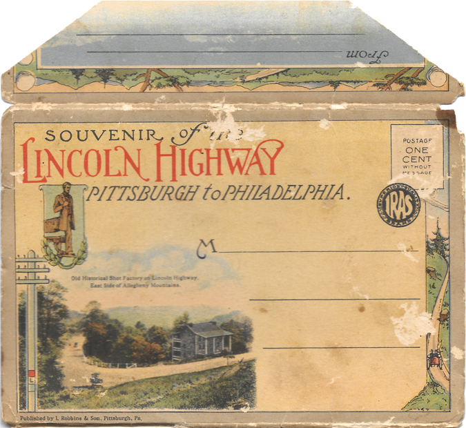
I found another little piece of American history at a nearby flea market. It cost me a dollar. The Lincoln Highway, the first coast-to-coast highway in the country, has a significant 324-mile leg in Pennsylvania.

Lincoln Highway top envelope
Lincoln Highway Postcards-1

I knew Mark would enjoy this one, since he grew up right off of the Lincoln Highway (Route 30).  The road crosses through Pennsylvania, but these first two are from right near his parents' house.

Lincoln Highway Postcards-2

Nearly a century of development have radically changed the land, but the shape of the road has more or less remained the same.  Mark was instantly able to explain to me where the pictures on these two postcards came from.

(Read more below.)

Lincoln Highway Postcards-3
Lincoln Highway Postcards-4

Lincoln Highway Postcards-5
Lincoln Highway Postcards-6

Lincoln Highway Postcards-7
Lincoln Highway Postcards-8
Lincoln Highway Postcards-9

Lincoln Highway Postcards-10
Lincoln Highway Postcards-11
Lincoln Highway Postcards-12
But not everything about the road has changed.  Many of the beautiful scenic views driving through the state are still found along the highway.  We're hoping to take a trip to Gettysburg sometime this year, which will take us directly along this route.  Maybe we can even find some of the same views that are in these postcards.
Lincoln Highway Postcards-13
Lincoln Highway Postcards-14
Lincoln Highway Postcards-15
Lincoln Highway Postcards-16
Lincoln Highway Postcards-17
Lincoln Highway Postcards-18

The Lincoln Highway, which stretches from San Francisco to New York City, was dedicated in 1913, and remains a well-traveled historic route. Even Rick Sebak, a well-known Pittsburgh documentary filmmaker (essentially a local legend), made a movie about the highway a few years ago.

Judging from the looks of the cars in the postcards, I'm guessing this booklet was distributed within a few years of the highway being dedicated. Like some of the other postcard booklets I've collected, these cards are attached and two-sided, and accordion fold in and out.

But more than anything, what makes this collection most special for me is the fact that I'm familiar with several of these areas. I haven't driven the Lincoln Highway intentionally, per se, but I've driven small parts here in Pennsylvania and Ohio. Seeing how roads and landscapes change over time is always fascinating to me.

Another fun fact: Back in the day, it could take 30 days to travel the road from end to end.

According to the Association's 1916 Official Road Guide a trip from the Atlantic to the Pacific on the Lincoln Highway, to make it in 30 days the motorist would need to average 18 miles an hour for six hours per day, and driving was only done during daylight hours.

I can't imagine driving thousands of miles at 18 mph, but of course, it was a different time 100 years ago.

How do you think roads and landscapes where you've lived have changed over the past century?

Wednesday, March 25, 2015

Meow Mail

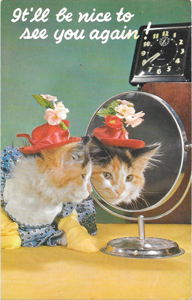
MeowMail-ItllBNice2CU

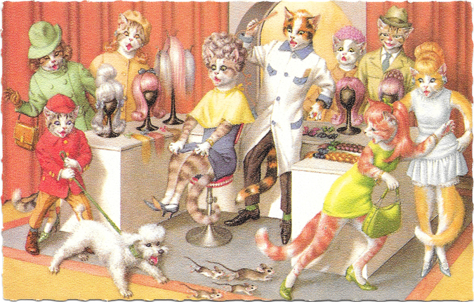
MeowMail-Salon

Hey yinz!

It feels good to put the fingers back to the keyboard. While I'm still not totally back in the blogging groove just yet, I'm trying to nail down more of a schedule as a motivating tool. I miss having this space, yet it the same time, its been nice to step away from things for a bit to refocus on what I'd like to accomplish here, but also, focus on things that aren't on the Internet. :)

ANYWHO. Let's talk about important things. Like these ridiculously awesome vintage kitty postcards I found recently. I've been on kind of a postcard binge at the last few flea markets where I've shopped. And I'm not sure which cat I love most in the salon scene, but I think I like the boy cat holding onto the dog. Haha.

I'm not gonna lie: If you follow me on Instagram, you know I've been a bit obsessed with my cat, Waldo, as of late. He's unlike any cat I've ever dealt with before, and he's kind of the best.

Por ejemplo:

Wally wanted to help with laundry, but I'm not sure this is going to work...

A photo posted by Kate (@thriftburgher) on

I've become a cat lady. But seriously, aren't cats the best? :D

Tuesday, October 14, 2014

Horseshoe Curve

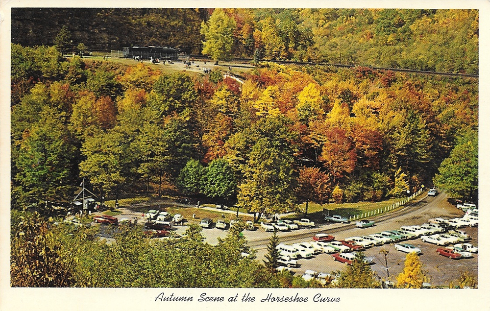
AltoonaCurvePostcard

According to RailRoadCity.com, when the Horseshoe Curve railroad track in Altoona, Pa. opened in 1854, it was a huge innovation for its time. Once the track opened, people could cross Pennsylvania at practically lightning speed: 15 hours!

Pennsylvania is a wide state, but you can probably drive from border to border in about 5 or 6 hours, present day.

As you can see, I did a little research for this postcard post. I know about the train track because it's local, and it's named after a minor baseball team in that town, but didn't know all of the details about why a railroad track that makes a 180 degree turn had so much fame.

The back of the postcard reads:

World famous Horseshoe Curve showing parking area visited by hundreds of tourists each year, Altoona, Pa.

Because of the topography in Western Pennsylvania being so hilly, traveling in the 1800s was very laborious, especially if trying to cross parts of the state with Appalachian Mountains.

I love the picturesque hills and trees of the region, but it still sometimes is a pain in the ass to get around. Haha. Pittsburgh is known not only for its bridges (rumor has it that Pittsburgh is home to more bridges than Florence, Italy), but for its tunnels and great scenic views, mostly because of the hills here.

I picked this postcard up in an antique shop last summer, I think, not far from where Altoona is located. I loved it because of the beautiful foliage; autumn is my favorite season. And the old cars in the photo are great. With the cars, my guess is the picture was probably taken in the late 1950s or early 1960s.

This is also the first postcard I decided to buy, eventually sparking this feature and my ridiculous postcard collection. We'll also be going through Altoona on an upcoming train trip Mark and I have planned. How exciting, right??

Are there any weird historical innovations that are known in your town or region?

Tuesday, October 7, 2014

Souvenir of Pittsburgh, Penna

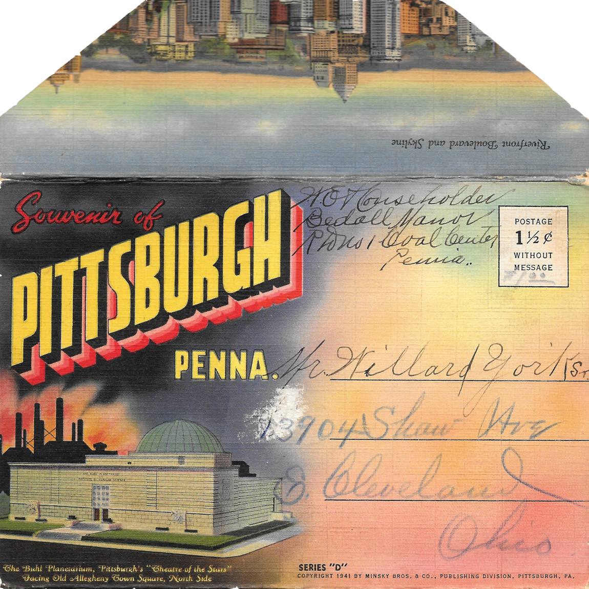
PittsburghIsCoolEnvelope

PittsburghIsCool1-McKeesRocksBridge

PittsburghIsCool2-CarnegieInstituteofTechnology

PittsburghIsCool3-PittStadium

PittsburghIsCool4-ForbesField

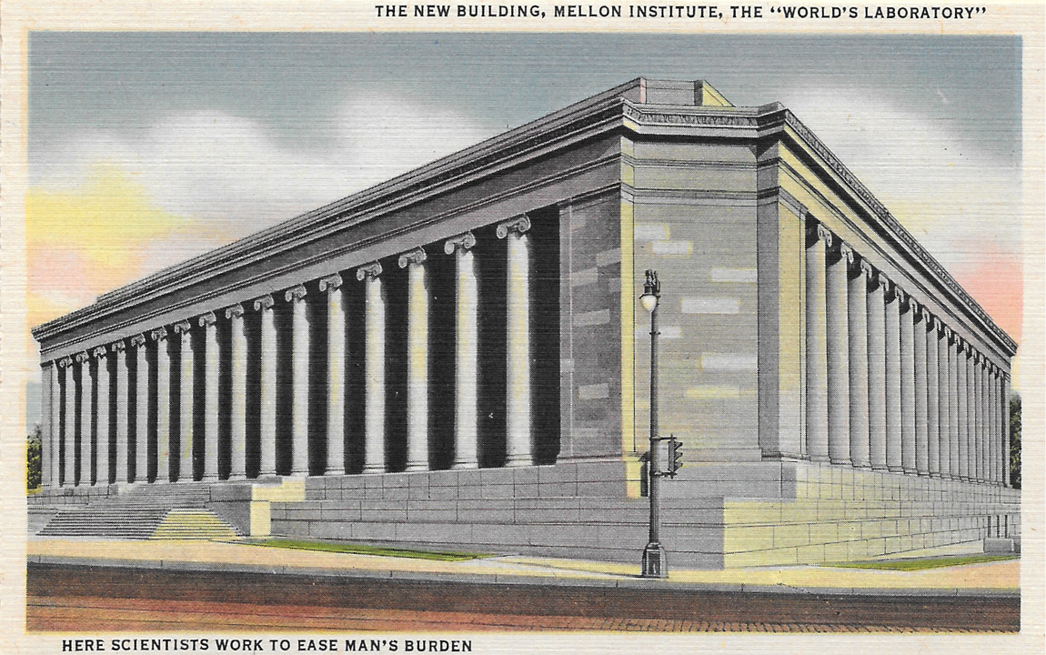
PittsburghIsCool5-MellonInstitute

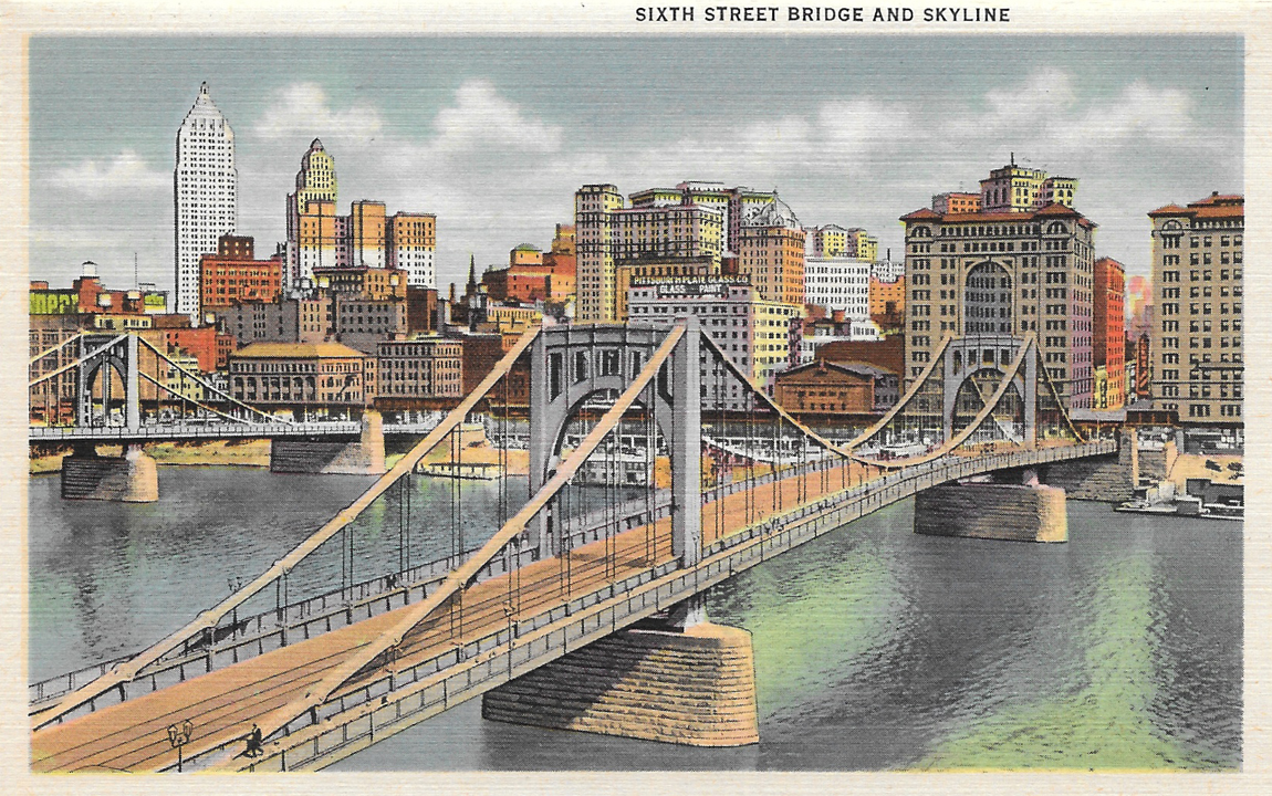
PittsburghIsCool6-SixthStreetBridge

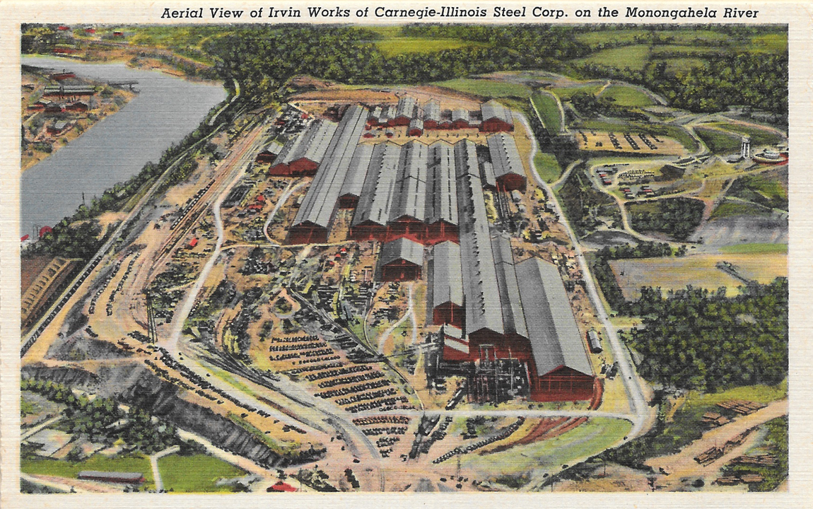
PittsburghIsCool7-IrvinWorks

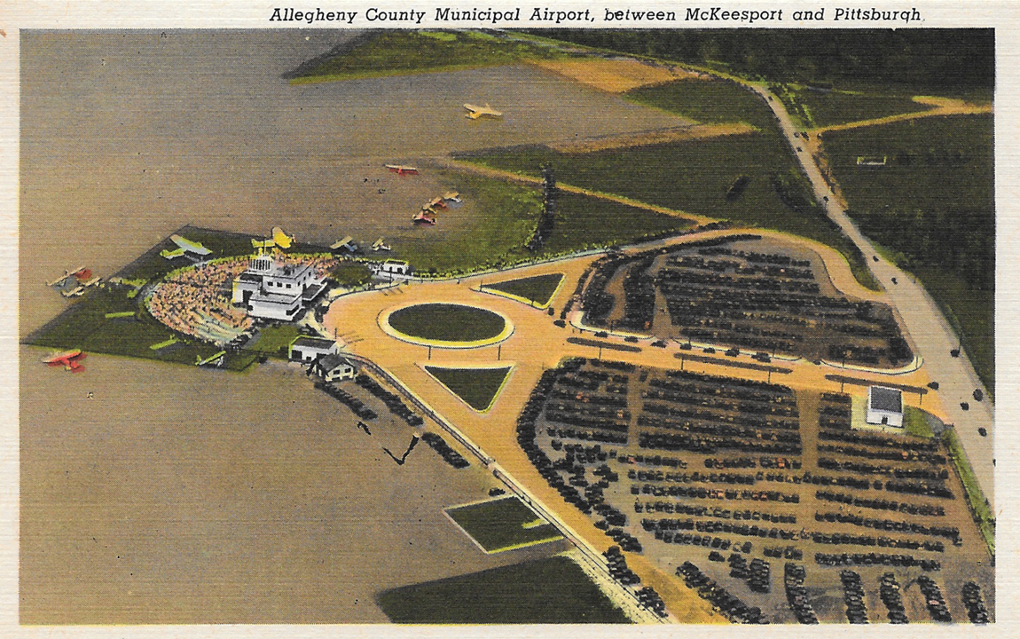
PittsburghIsCool8-Airport

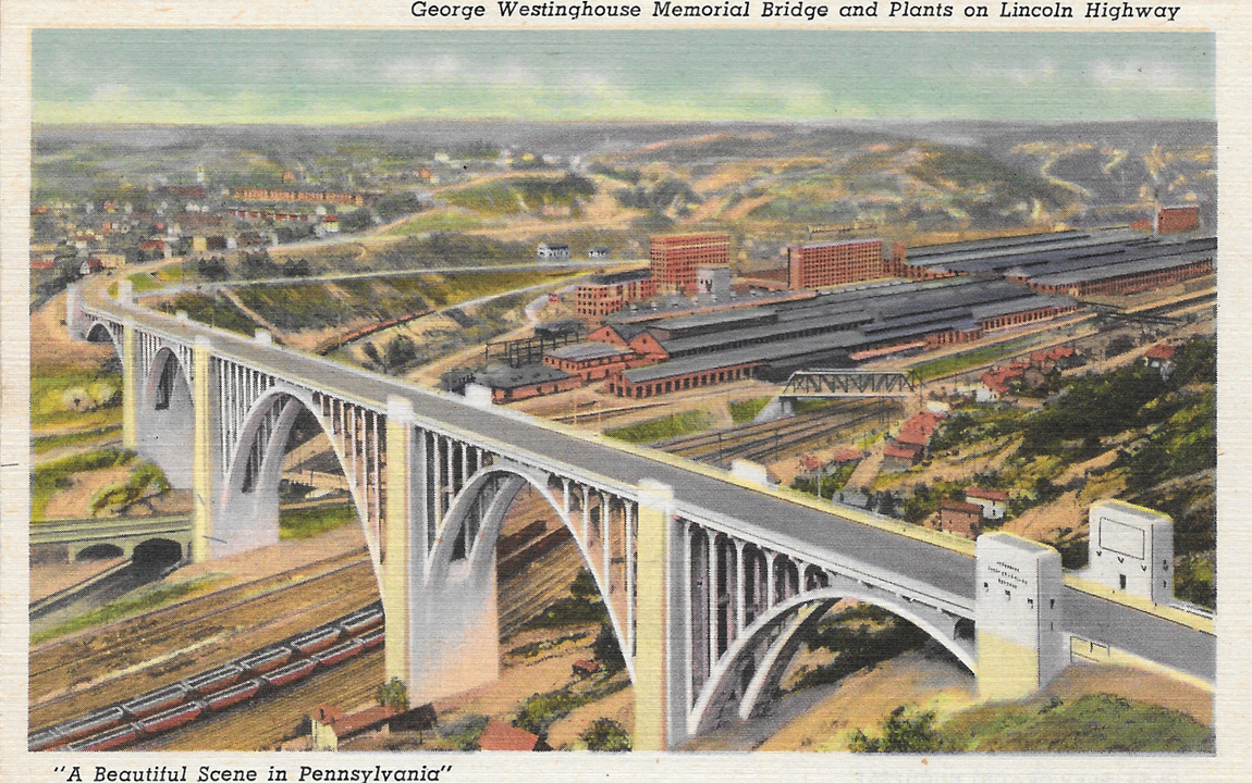
PittsburghIsCool9-GeorgeWestinghouseBridge

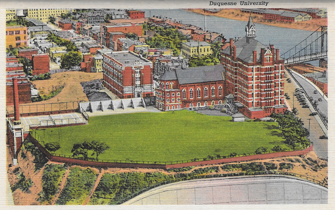
PittsburghIsCool10-DuquesneUniversity

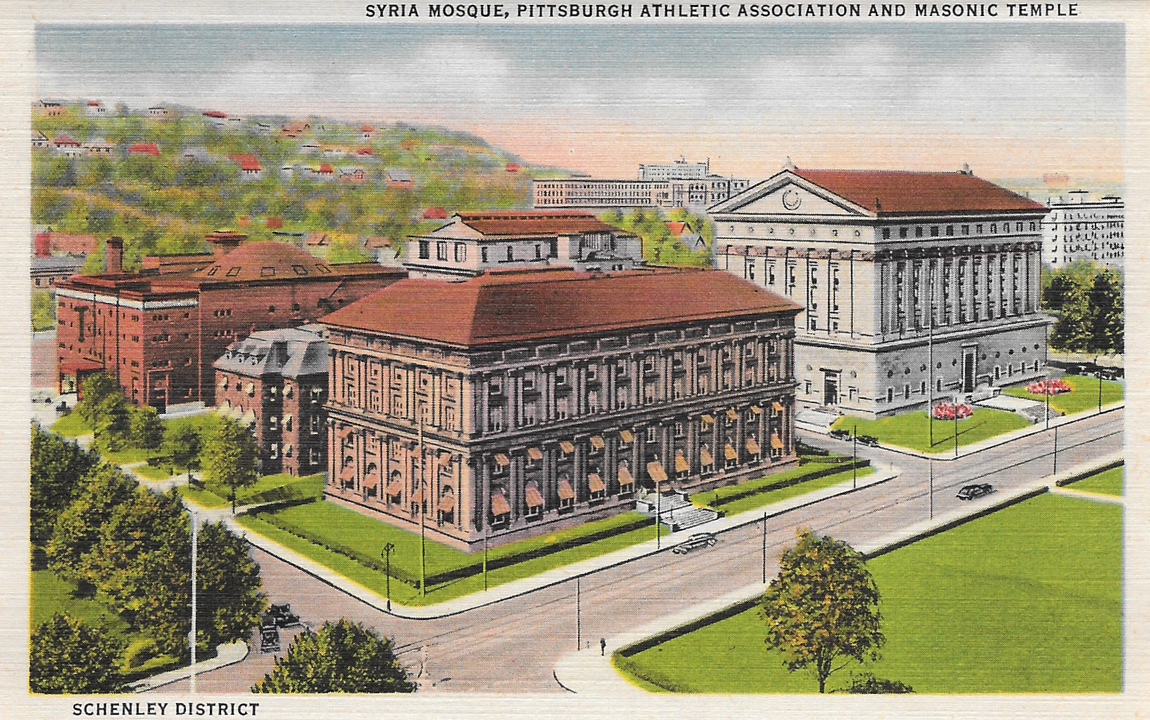
PittsburghIsCool11-SyriaMosque

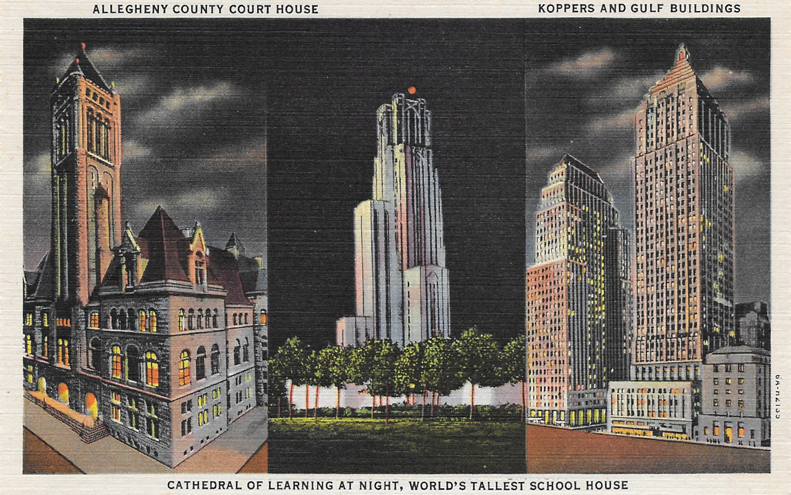
PittsburghIsCool12-Trifecta

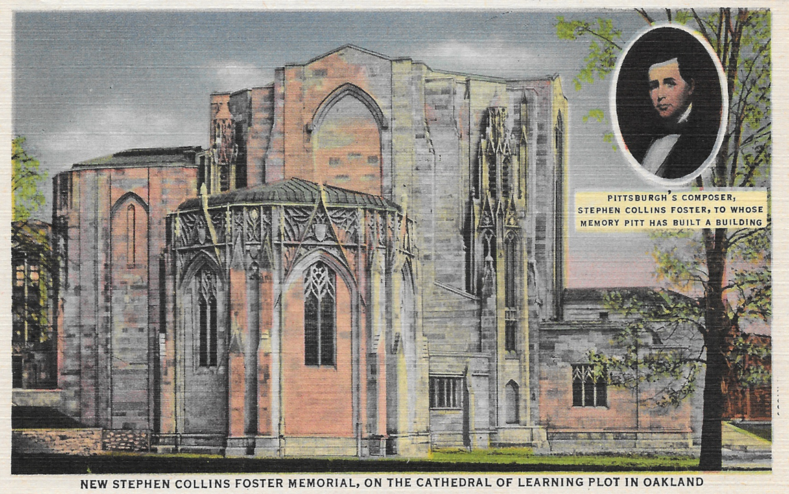
PittsburghIsCool13-FosterMemorial

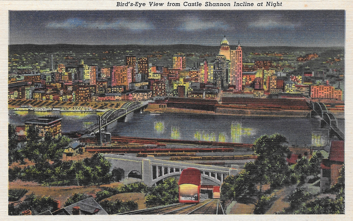
PittsburghIsCool14-InclineView

PittsburghIsCool15-LibertyBridge

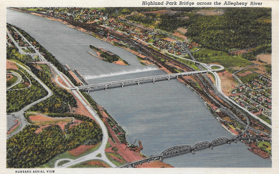
PittsburghIsCool16-HighlandParkBridge

PittsburghIsCool17-Planes

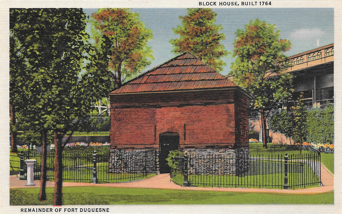
PittsburghIsCool18-FortDuquesne

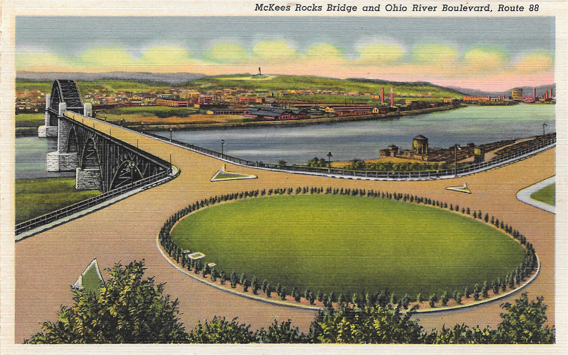
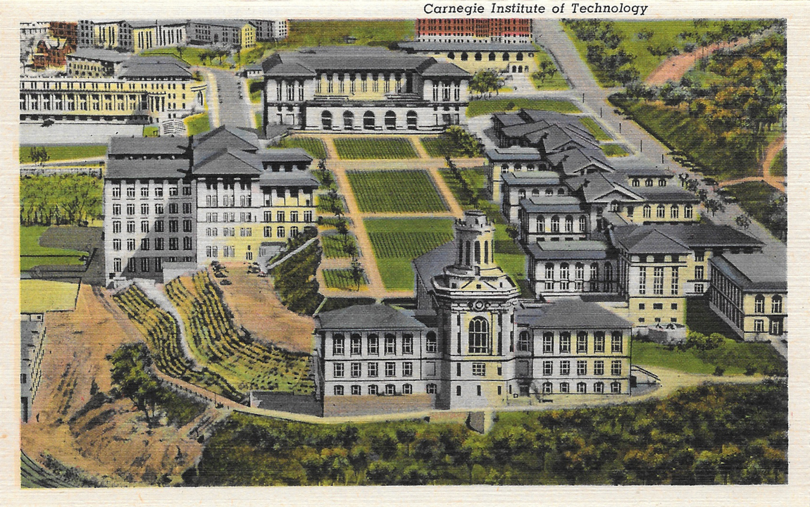
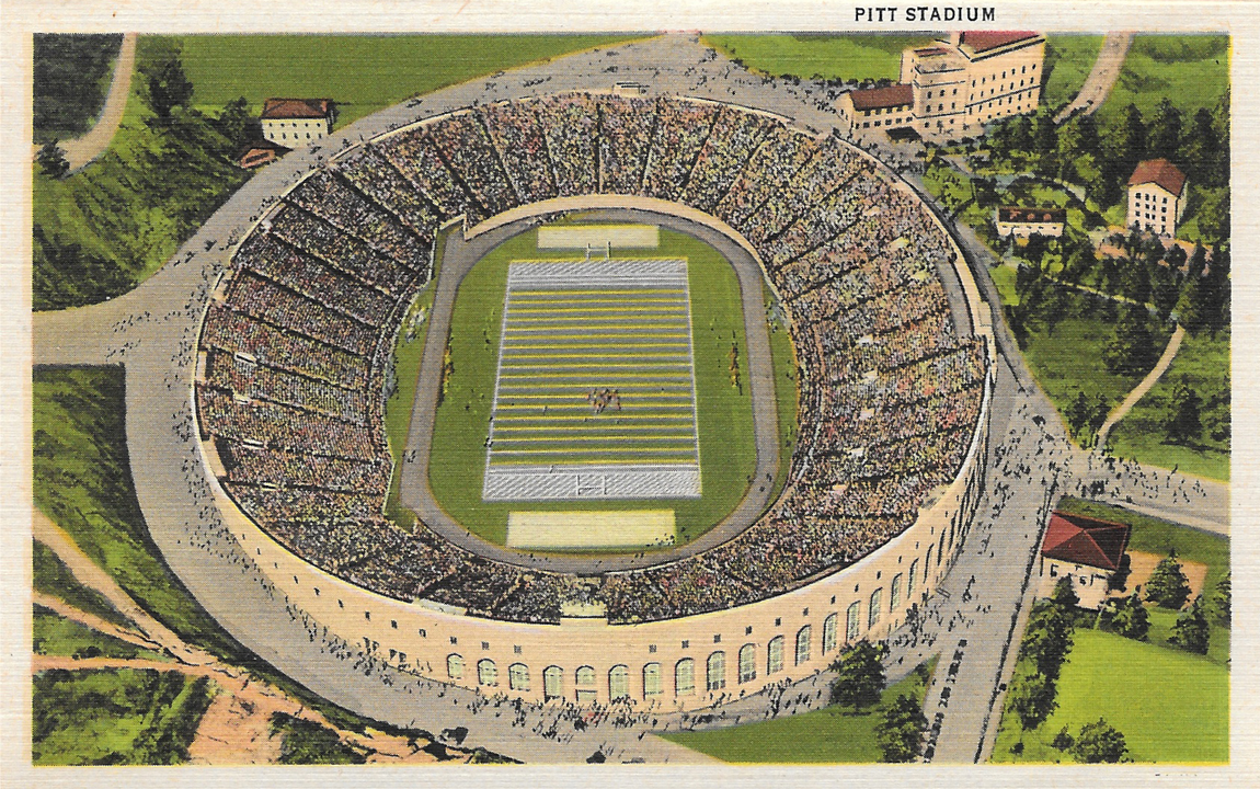
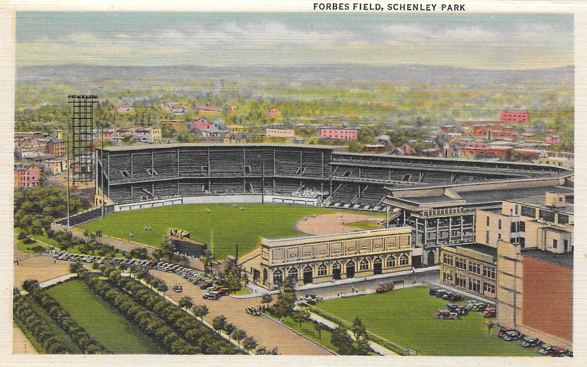
While perhaps not as exciting as my other Pittsburgh postcard collection, this is still a pretty cool set. It's not as exciting because 1.) It's newer (from 1941, vs. the other one, from 1914) and 2.) Mark bought it on Etsy for my birthday.

However, it does include photos featuring some of the city's world-class charm, including a few of the city's many bridges, my college alma mater, Duquesne University. That's also where Mark and I met. :)

It is sorta like the other set, in that it's according style, with all the postcards connecting to one another, and postcard photos are printed on both sides.

That first postcard threw me off a bit, because there totally aren't any traffic circles here now. And I'm so thankful for that, because I think I have a heart attack every time I drive through one of those.

Tuesday, September 23, 2014

Pittsburgh 200th

Postcard&LetterFindsfromRogers-Scanned2014-07-05-28

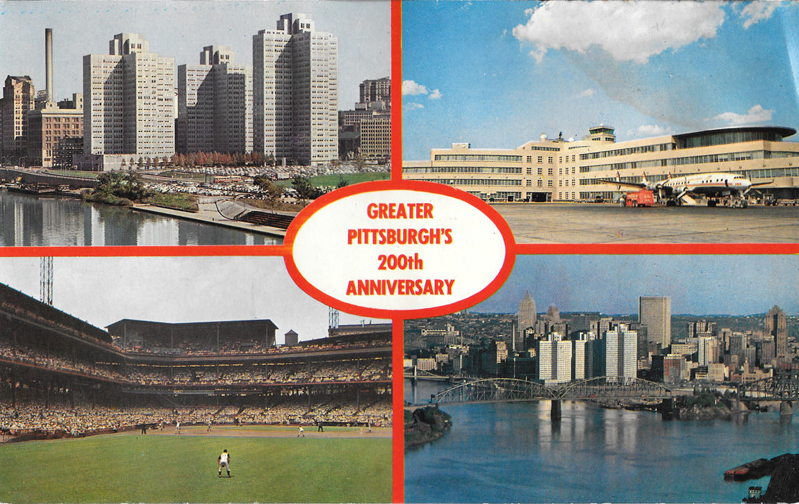
Pittsburgh's bicentennial year was in 1958. I know this because the 250th anniversary was celebrated in 2008. Sad but true. I love that Pittsburgh is an older city. I think that's where it gets a lot of its charm. The history is rich. But I guess, compared to most European cities, Pittsburgh is still fairly young.

This postcard in particular is about double the standard size, and was a little beat up, but thought was worth having, if for nothing else, to simply have yet another Pittsburgh postcard. :)

There's still been so much growth since then, too.

Tuesday, September 9, 2014

Down in Texas

Cover@TexasPostcard

Text@TexasPostcard

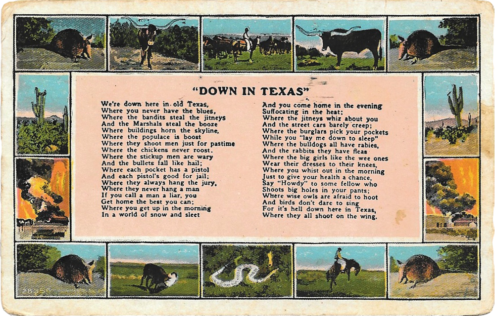
Got this postcard while I was in Texas, because, well, I kind of had to do it. :)

Front:

"Down in Texas"

We're down here in old Texas
Where you never have the blues
Where the bandits steal the jitneys
And the Marshals steal the booze
Where buildings horn the skyline,
Where the populace is boost
Where they shoot mean just for past time
Where the chickens never roost.

Where the stickup men are wary
And the bullets fall like hail;
Where each pocket has a pistol
And each pistol's good for jail;
Where they always hang the jury,
Where they never hang a man
If you call a man a liar, you
Get home the best you can;

Where you get up in the morning
In a world of snow and sleet
And you come home in the evening
Suffocating in the heat;
Where the jitneys whiz about you
And the street cars barely creep;
Where the burglars pick your pockets
While you 'lay me down to sleep'

Where the bulldogs all have rabies,
And the rabbits they have fleas
Where the big girls like the wee ones
Wear their dresses to their knees,
Where you whist out in the morning
Just to give your health a chance.

Say 'Howdy' to come fellow who
Shoots big holes in your pants;
Where wise owls are afraid to hoot
And birds don't dare to sing
For it's hell down here in Texas,
Where they all shoot on the wing.

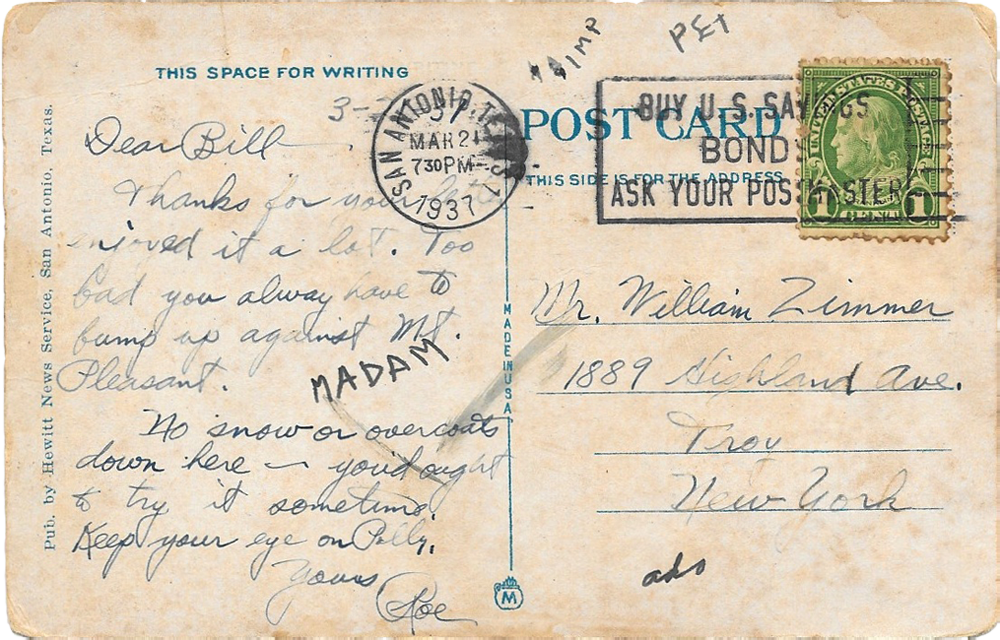
Back:

Dear Bill —
Thanks for your letter, enjoyed it a lot. Too bad you always (sic) have to bump up against Mt. Pleasant.No snow or over coats down here — you'd aught to try it sometime. Keep your eye on Polly.
Yours, Roe

I would've liked to have found an Austin postcard, but this was as good as it got for me. I'll try to post other postcards I got in Texas (and Ohio) in the coming weeks.

Tuesday, July 29, 2014

The Mon has Mystique

TheMon

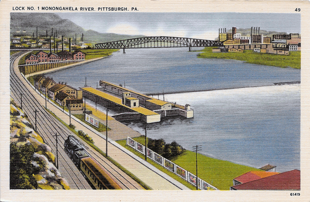
I found this postcard during our Cleveland trip a few weekends ago, at Sweet Lorain.

From what I've learned about postcards over the past few months, this card was printed between the 1930s and 1951, because of its white border, the contrasting colors, and the linen finish. I know it was printed before 1952, when stamp cost was raised to two cents instead of a penny.

I'm not even exactly sure of the location, since I'm pretty sure Lock No. 1 along the Monongahela (often called the Mon) no longer exists.

Regardless, I know the city looks nothing like this now. My guess is this was taken from South Side or Mt. Washington. The current Station Square is on distant left, where a booming railroad station once stood, downtown on the right, with what is now Smithfield Street Bridge connecting them.

This postcard was published by the Pittsburgh News Company, and has no description of the scenery.

Even though a lot of aspects of this card remain mysterious, I'm glad I was able to add a few more Pittsburgh cards to my collection.

The image actually makes me think of this place in South Side, off a running trail that runs parallel to the river. There is this huge cement slab, about 10 by 15 feet, hidden behind bushes off the trail that sits along the river. A lot of people called it the slab. It's kind of like a peaceful little place, where you can have a great view of the city, witnessing chaos and craziness, but be in complete peace because it was isolated from everything. I haven't been there in forever, probably since college, but maybe I can seek it out again.

So who's willing to talk about their secret place? ;)

Tuesday, July 15, 2014

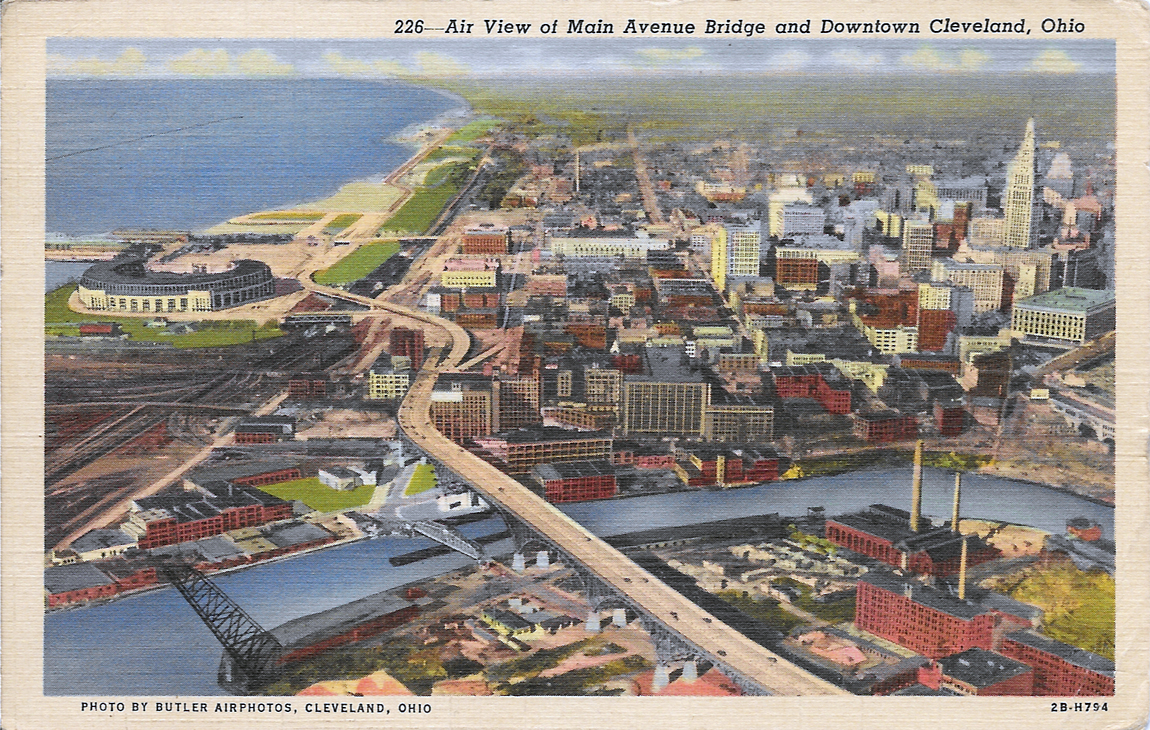
Cleveland: An Aerial View

AerialView@Cleveland

AerialView@ClevelandBack

I picked this up at a flea market the weekend before Mark and I went to Cleveland. It seems appropriate to have an arsenal of cards from any cool rustbelt city, especially in it's heyday.

I can vouch the place looks a bit different now.

The postcard reads:

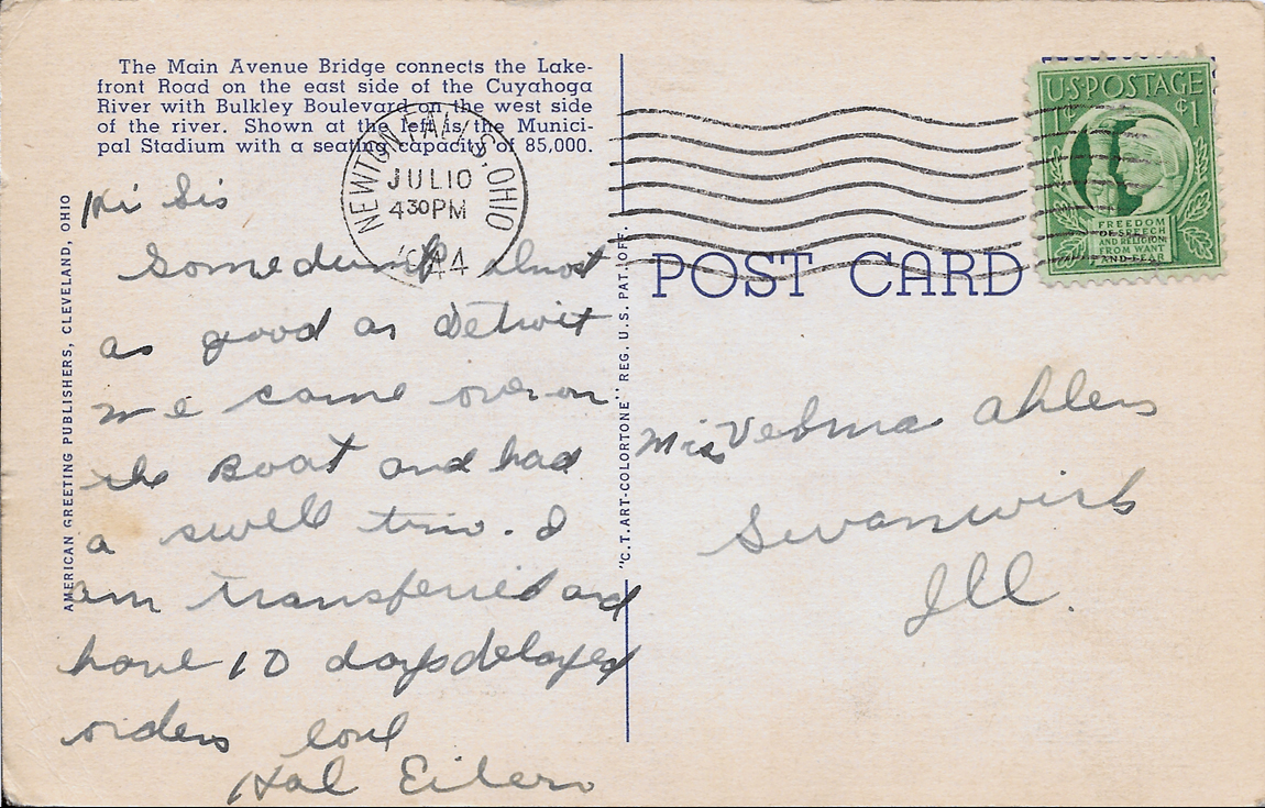
"The Main Avenue Bridge connects the Lakefront Road on the east side of the Cuyahoga River with Bulkley Boulevard on the west side of the river. Shown at the left is the Municipal Stadium with a seating capacity of 85,000."

It was also mailed, and postmarked July 10, 1944. Note reads:

Hi Sis

Some (do it?) almost as good as Detroit. We came over on the boat and had a swell time. I am transferred and home 10 days delayed riders.

Love
Hal Eiler

I've been picking up more postcards with notes on the back. I almost appreciate them more because they were sent to loved ones who held onto them, cherished them, maybe even read them over and over again over the years.

Tuesday, July 8, 2014

Pittsburgh: 100 Years Past

BookletFront

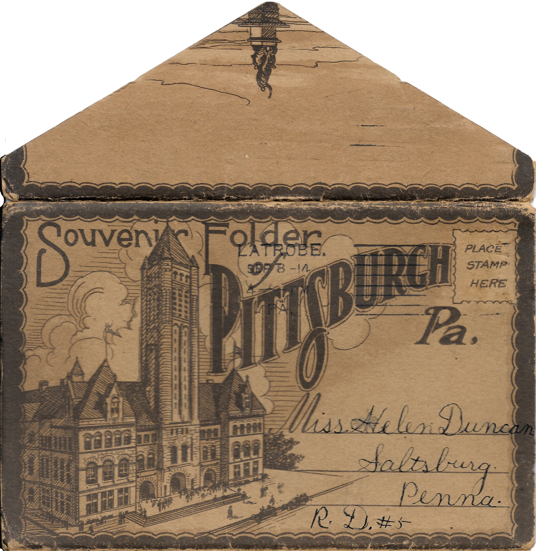
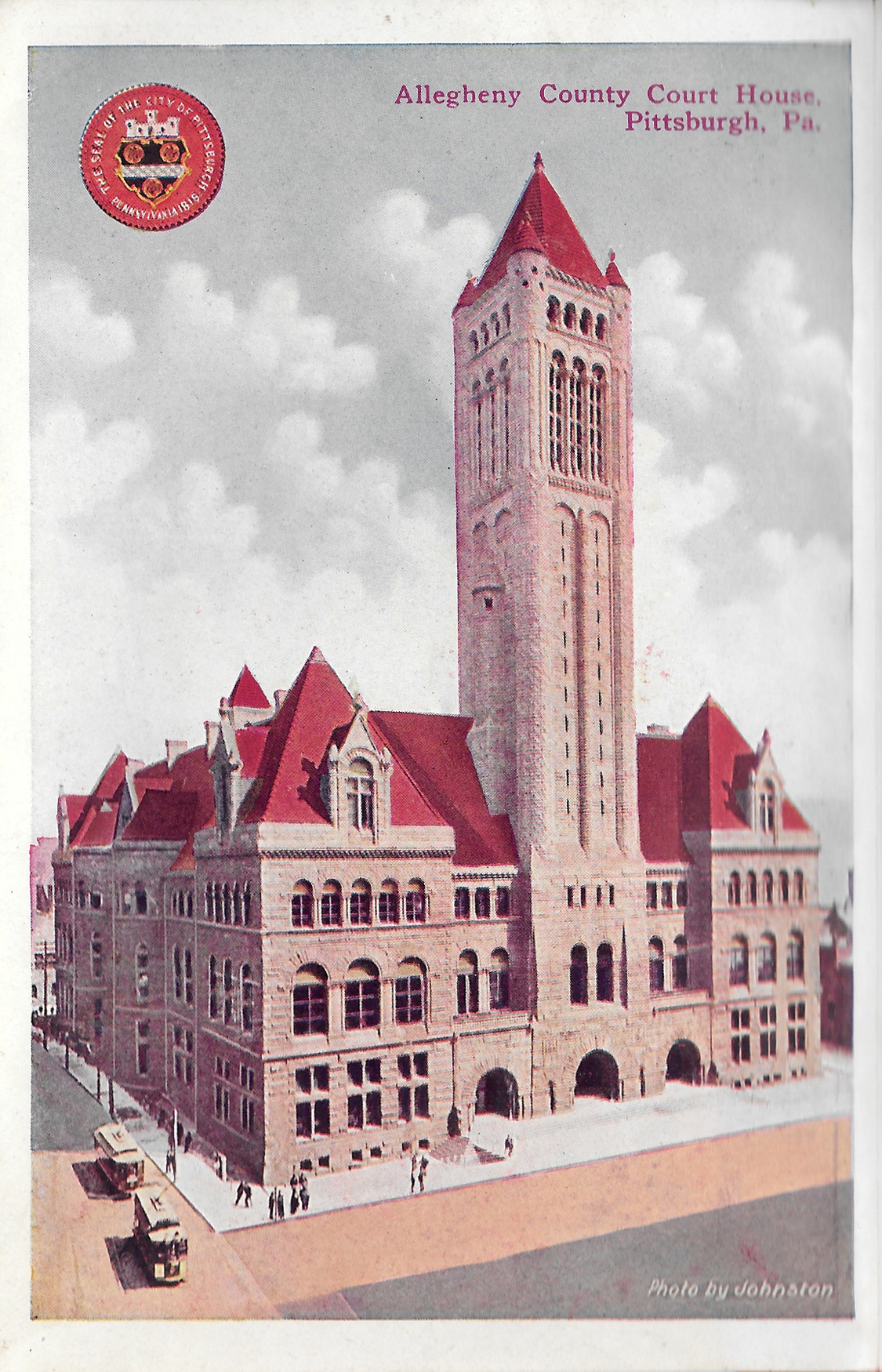
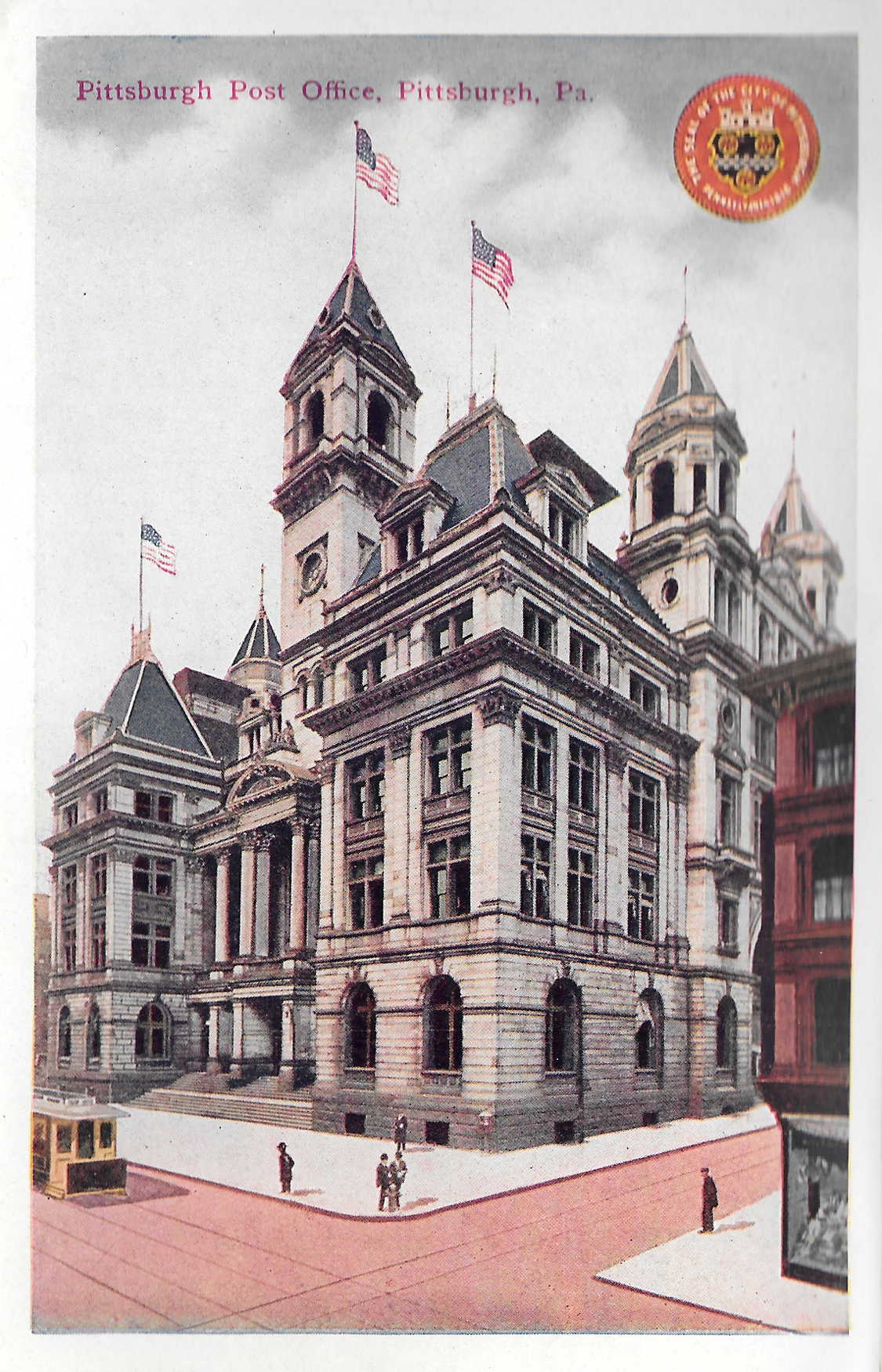
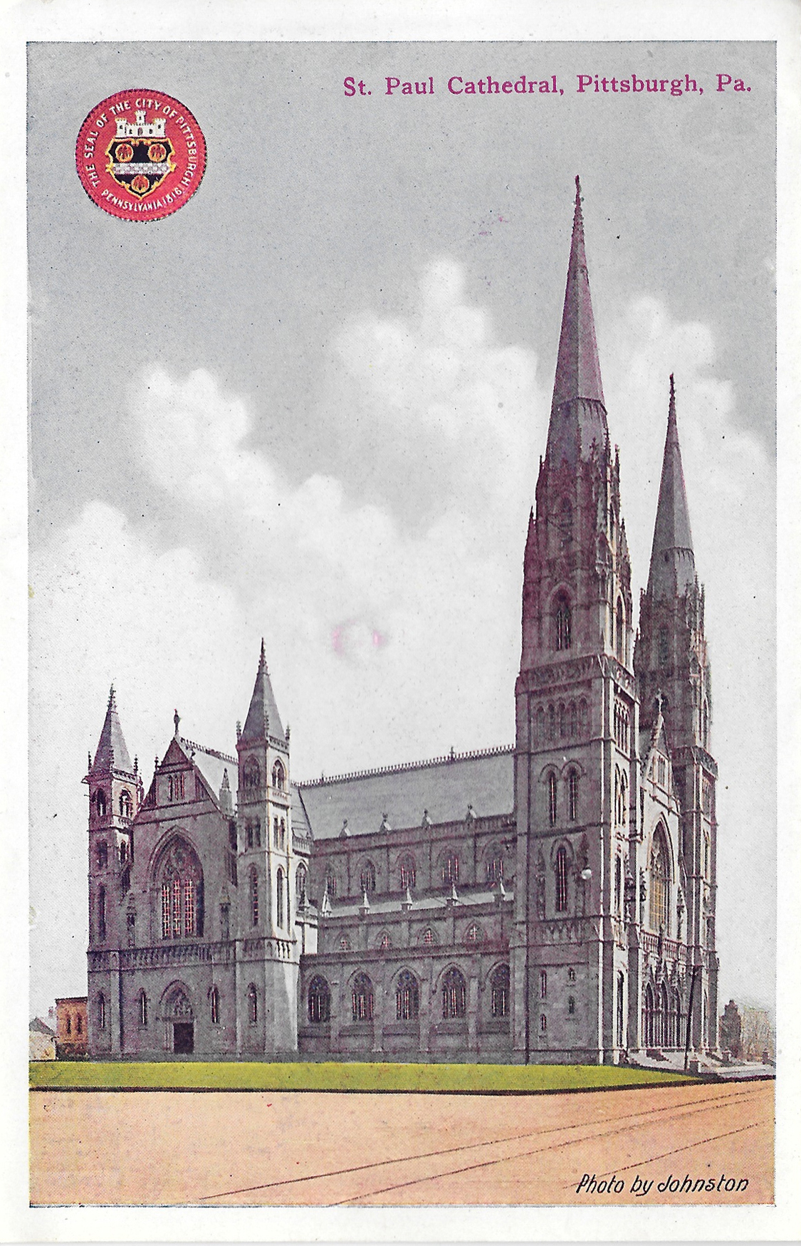
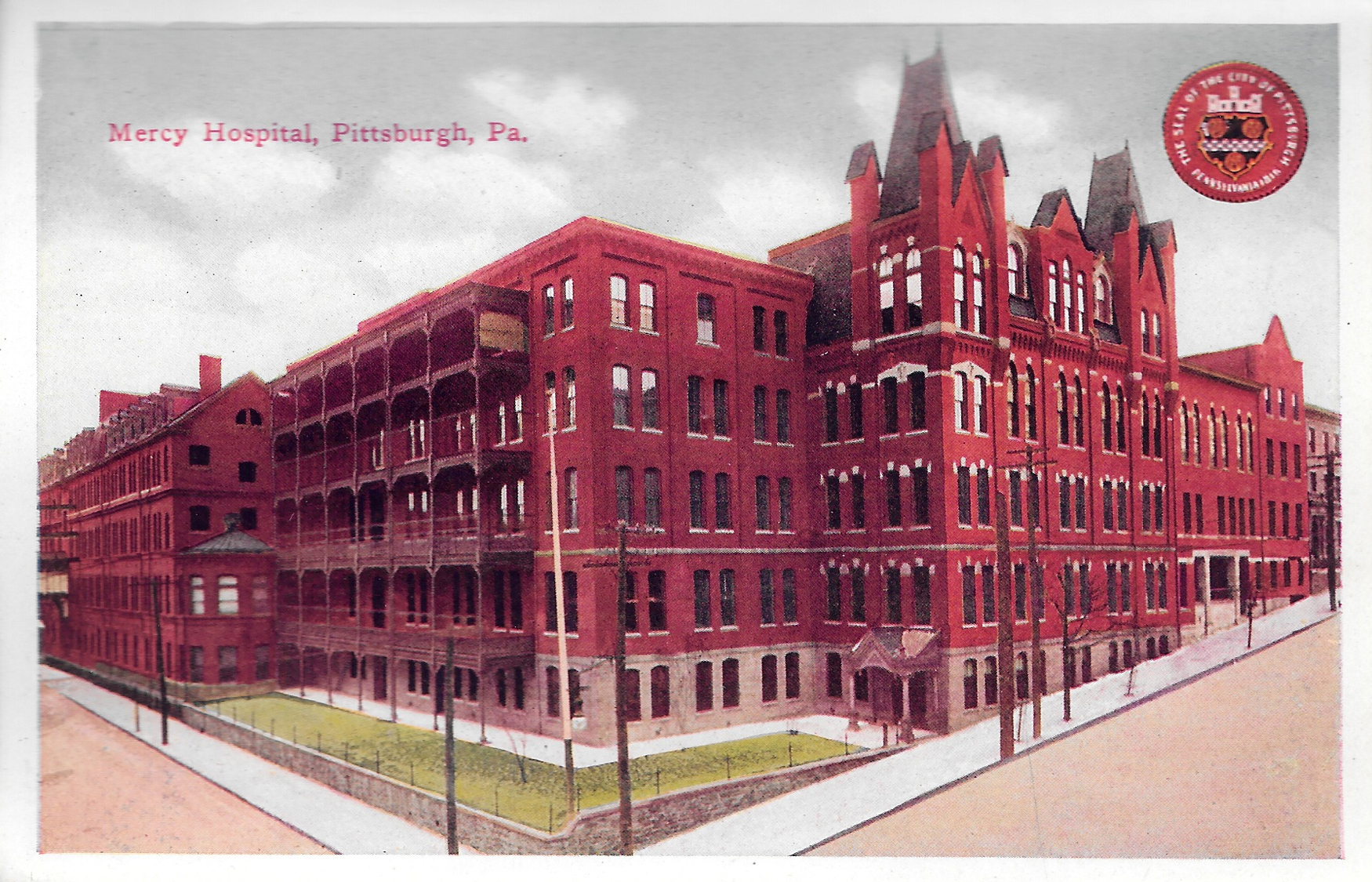
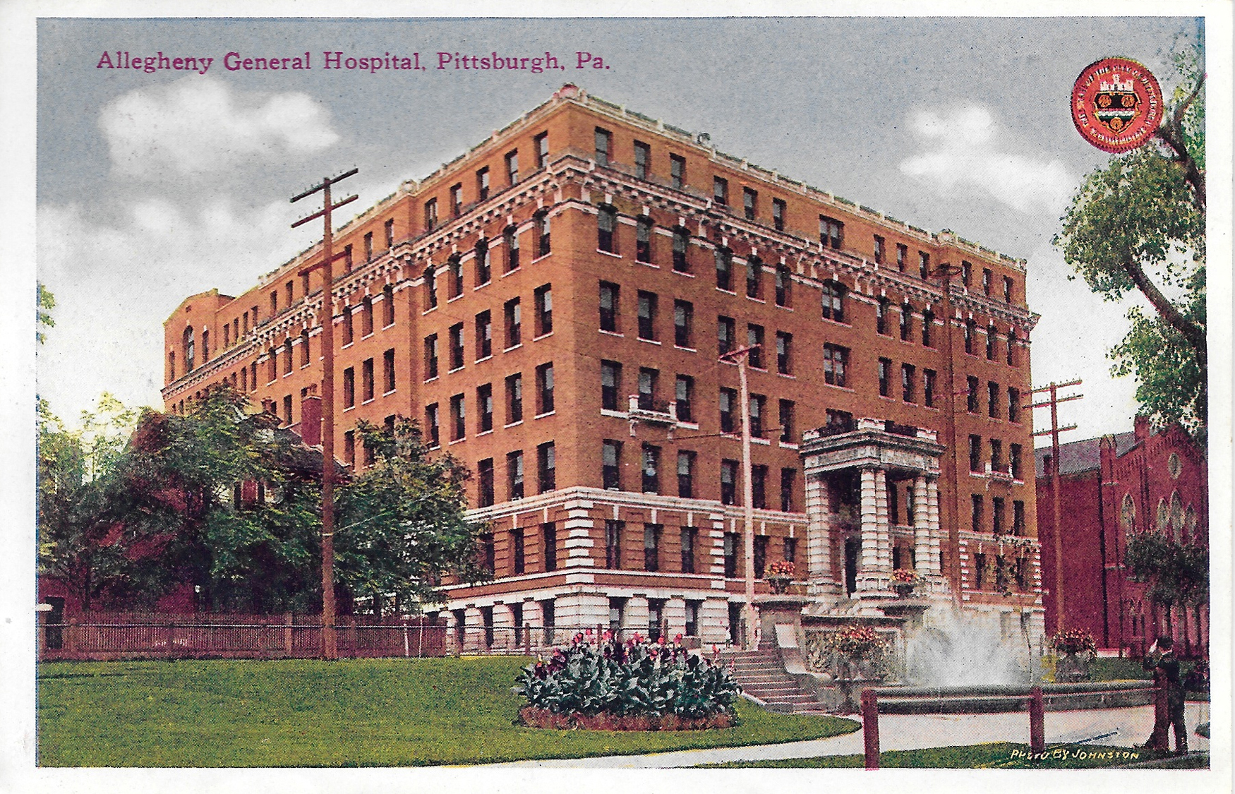
I'm still stunned I found this at Rogers Community Auction over the weekend. It's a postcard booklet, with locations printed on the front and back. The postmark is dated September 1914. I paid $5 for it.

Postcard1-AlleghenyCountyCourthouse

Allegheny County Courthouse, Downtown Pittsburgh

Postcard2-NewOliverBuilding

Postcard3-PittsburghPostOffice

Postcard4-StPaulCathedral

St. Paul Cathedral, Oakland

Postcard5-MercyHospital

Mercy Hospital, Uptown

Postcard6-AlleghenyGeneralHospital

Allegheny General Hospital, North Side

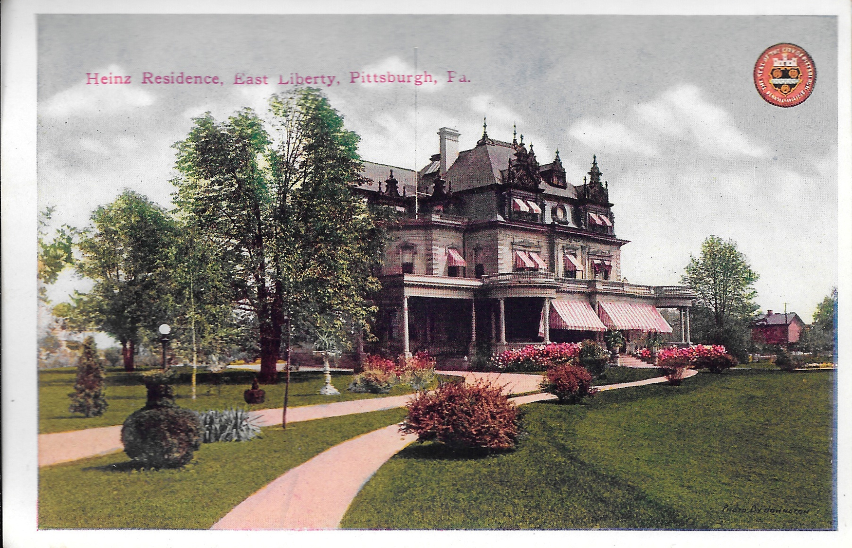
Postcard7-HeinzResidence

Heinz Residence, East Liberty

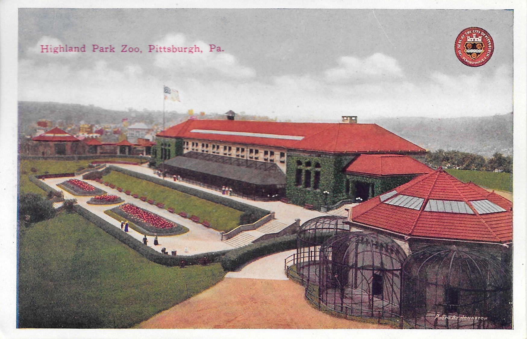
Postcard8-HighlandParkZoo

Highland Park Zoo, Highland Park (Now just the Pittsburgh Zoo)

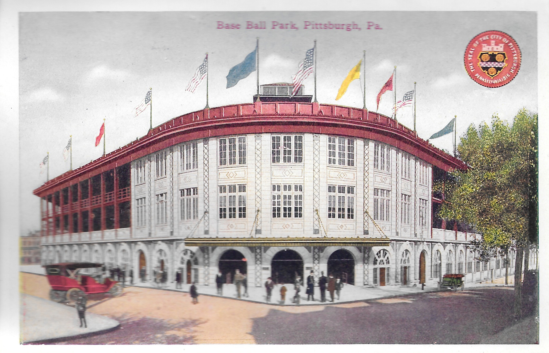
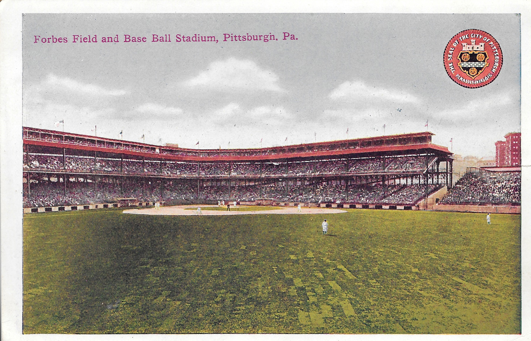
Postcard9-BaseballPark

Baseball Park, aka Forbes Field, Oakland

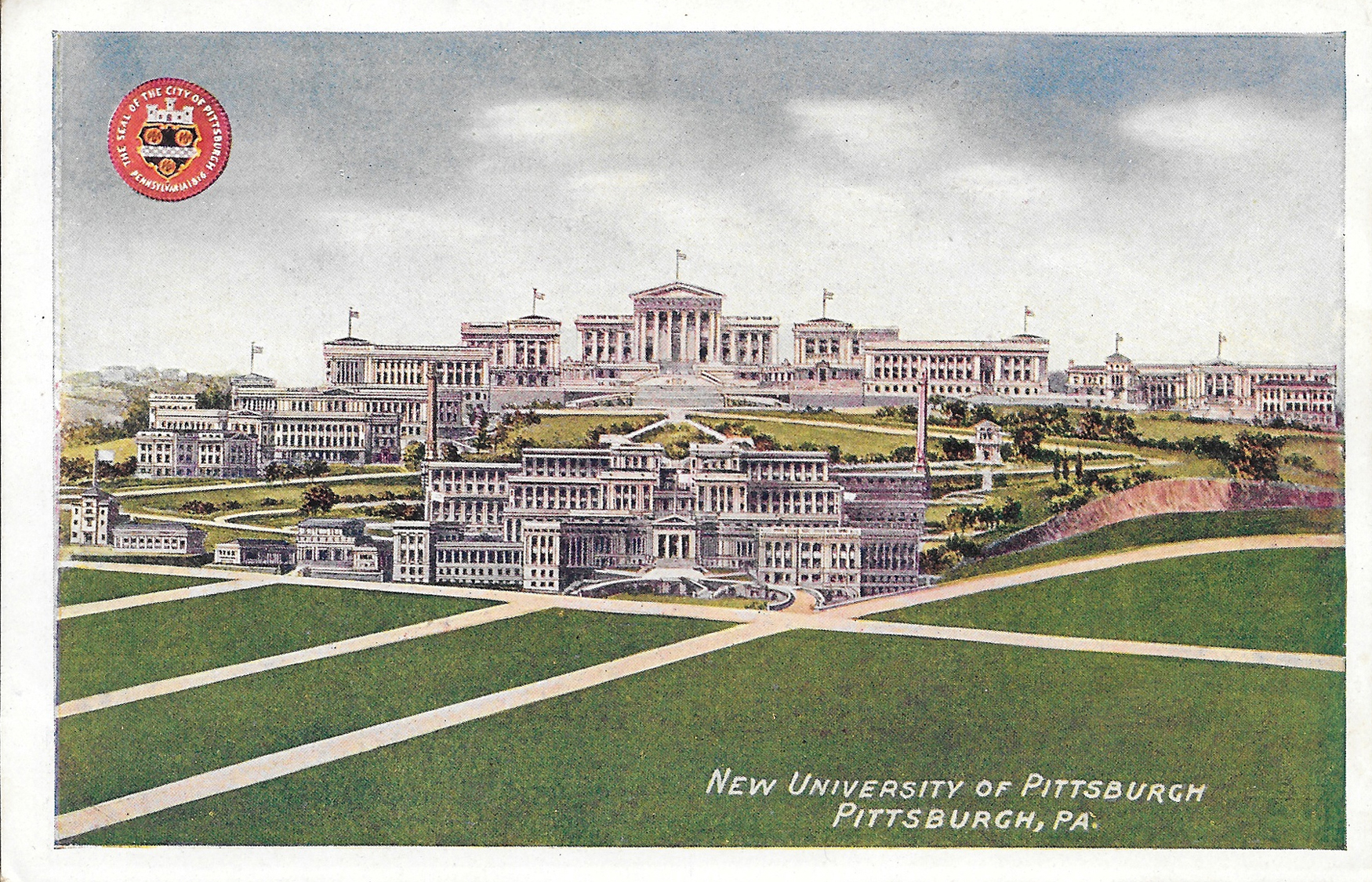
Postcard10-NewUniversityofPittsburgh

"New" University of Pittsburgh, Oakland

Postcard11-ForbesField

Forbes Field, Oakland

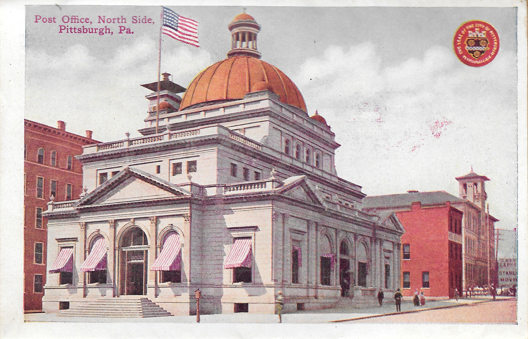
Postcard12-PostOfficeNorthSide

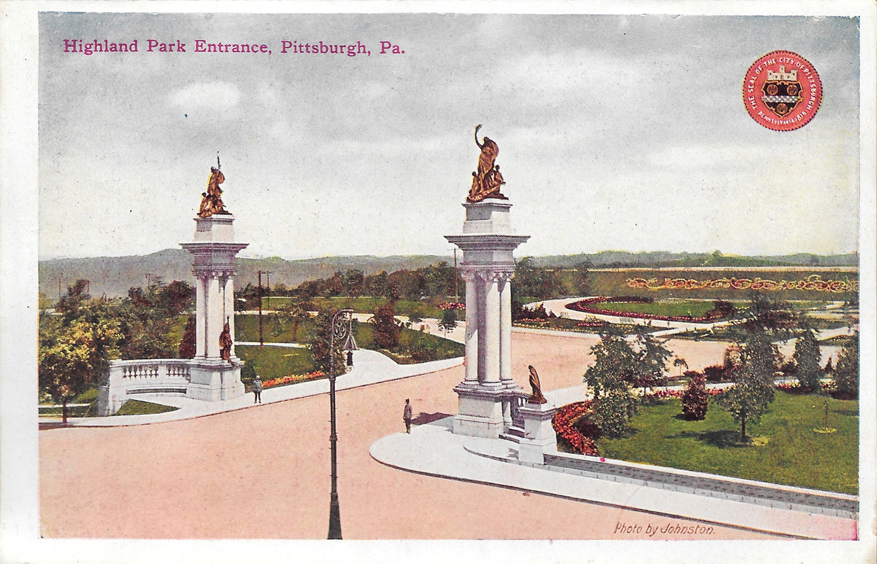
Postcard13-HighlandParkEntrance

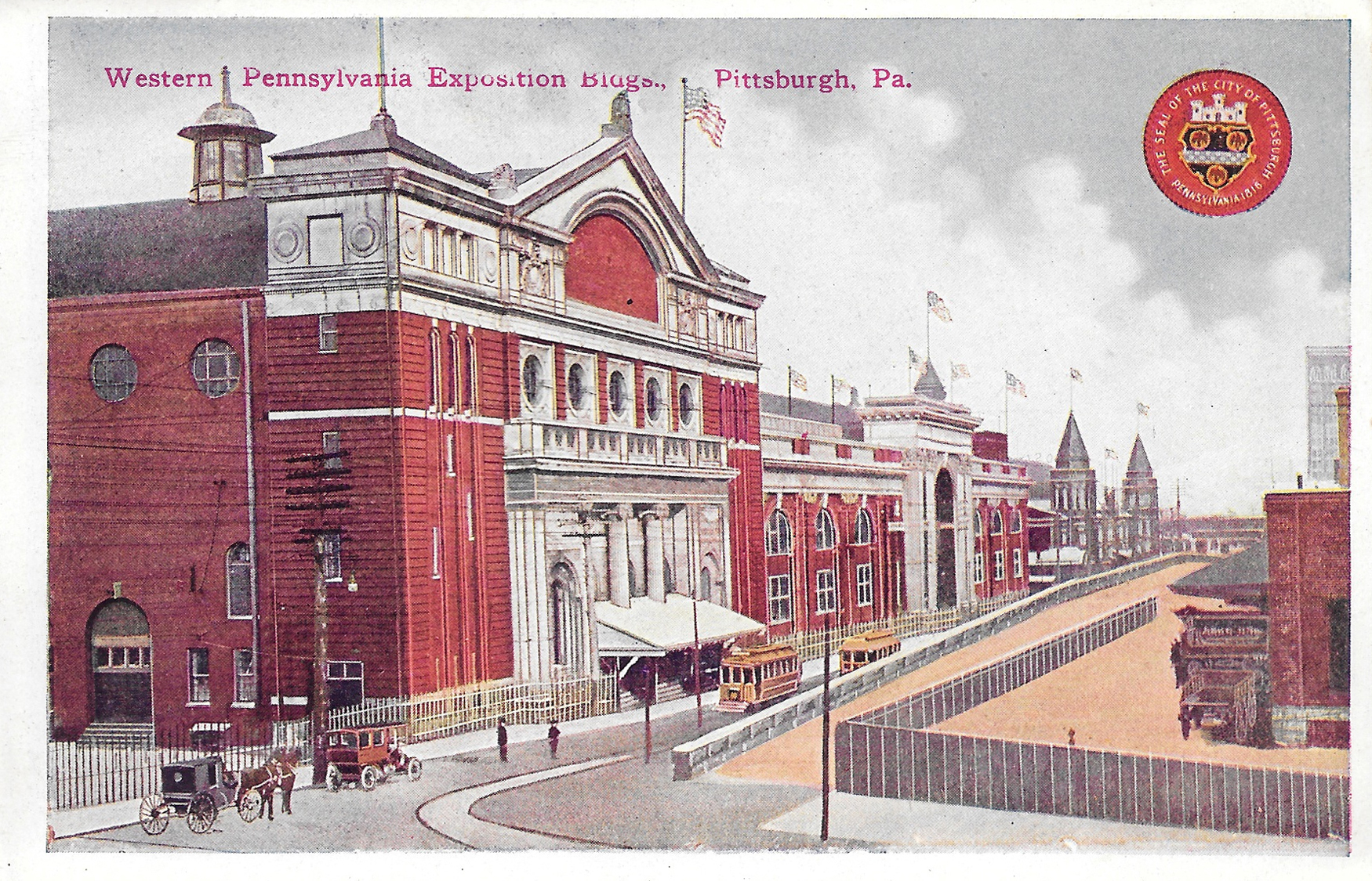
Postcard14-WesternPaExpositionBuildings

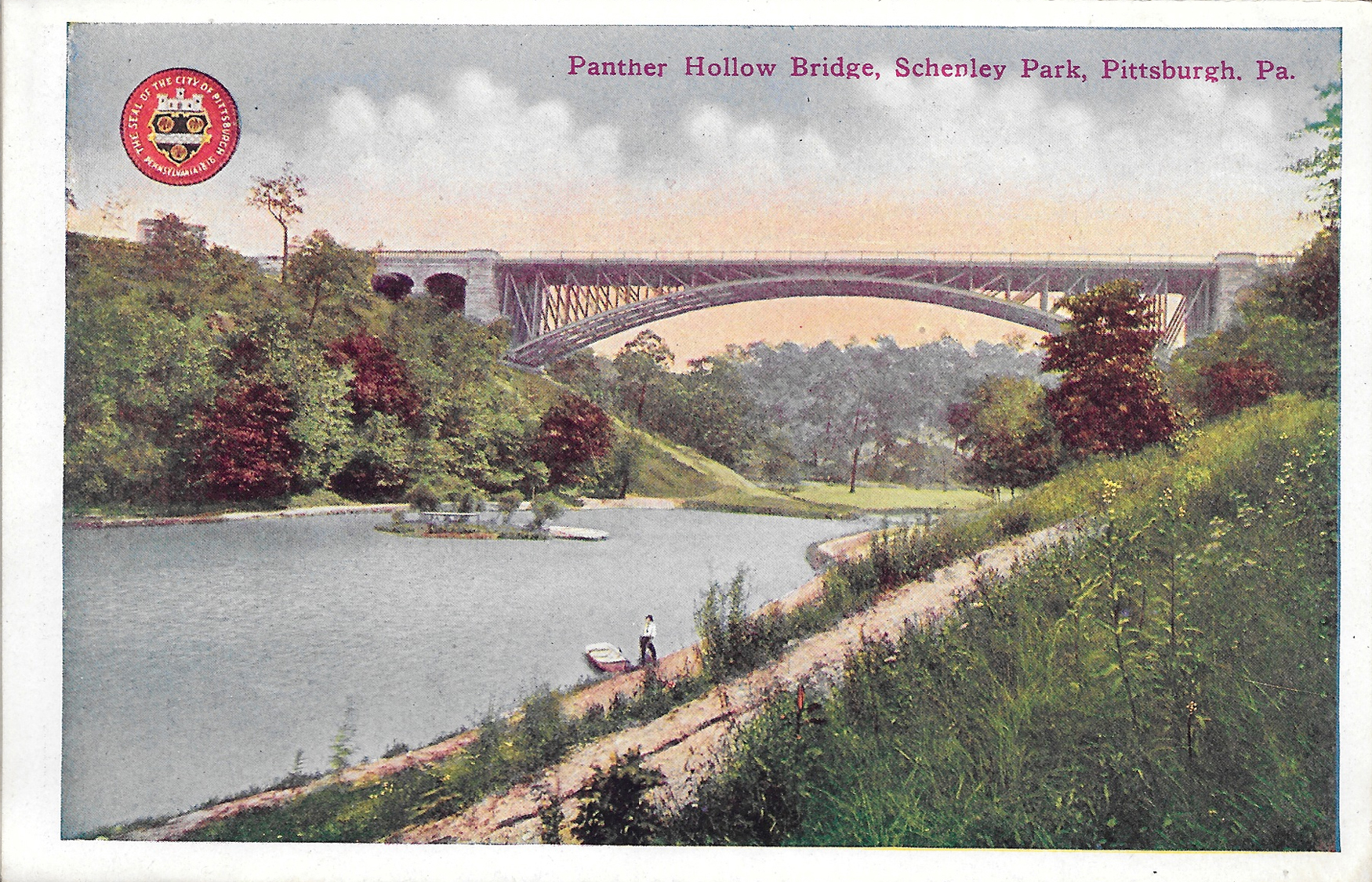
Postcard15-PantherHollowBridgeSchenleyPark

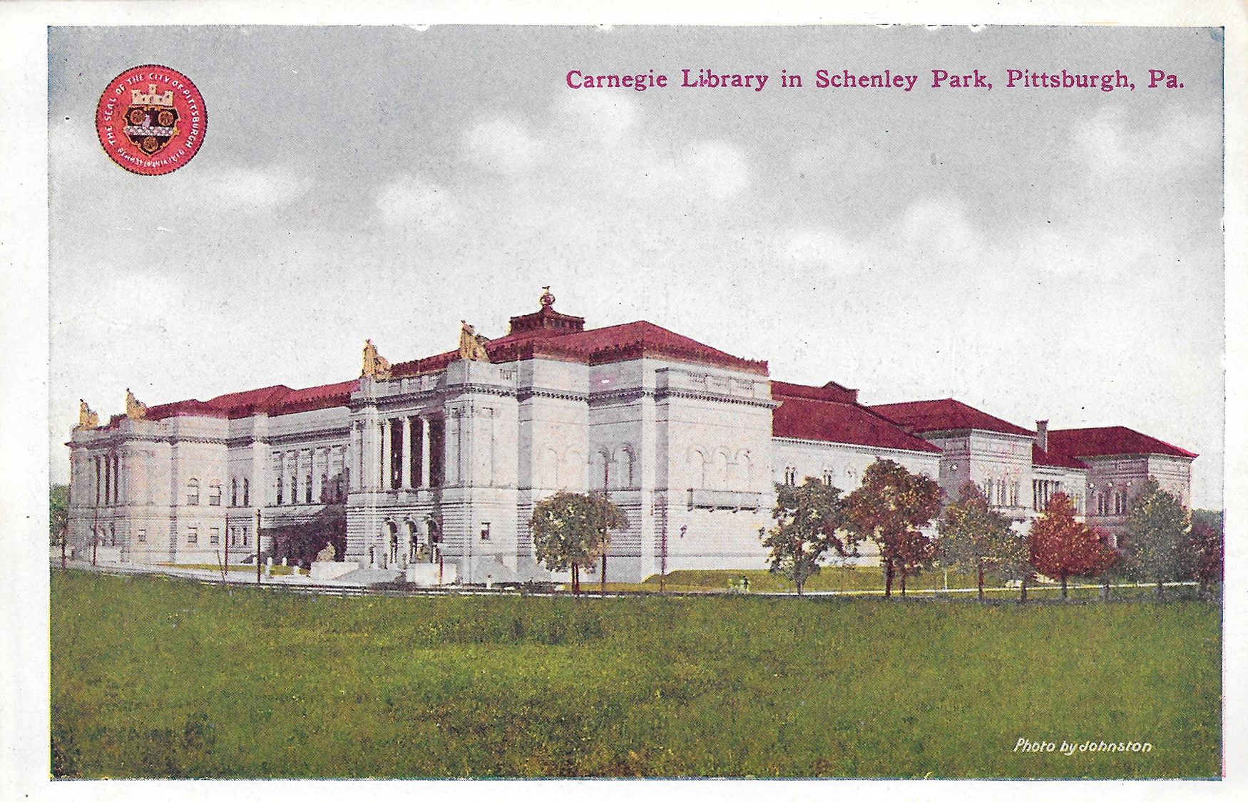
Postcard16-CarnegieLibrarySchenleyPark

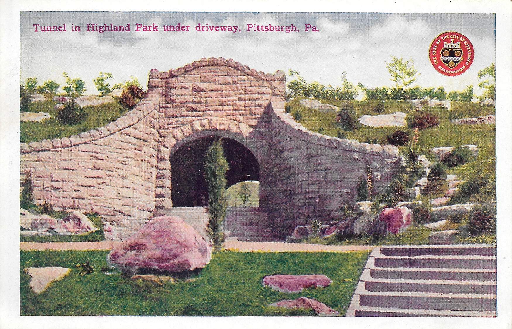
Postcard17-TunnelInHighlandPark

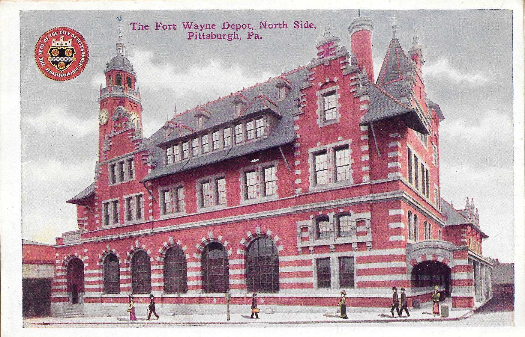
Postcard18-TheFortWayneDepotNorthSide

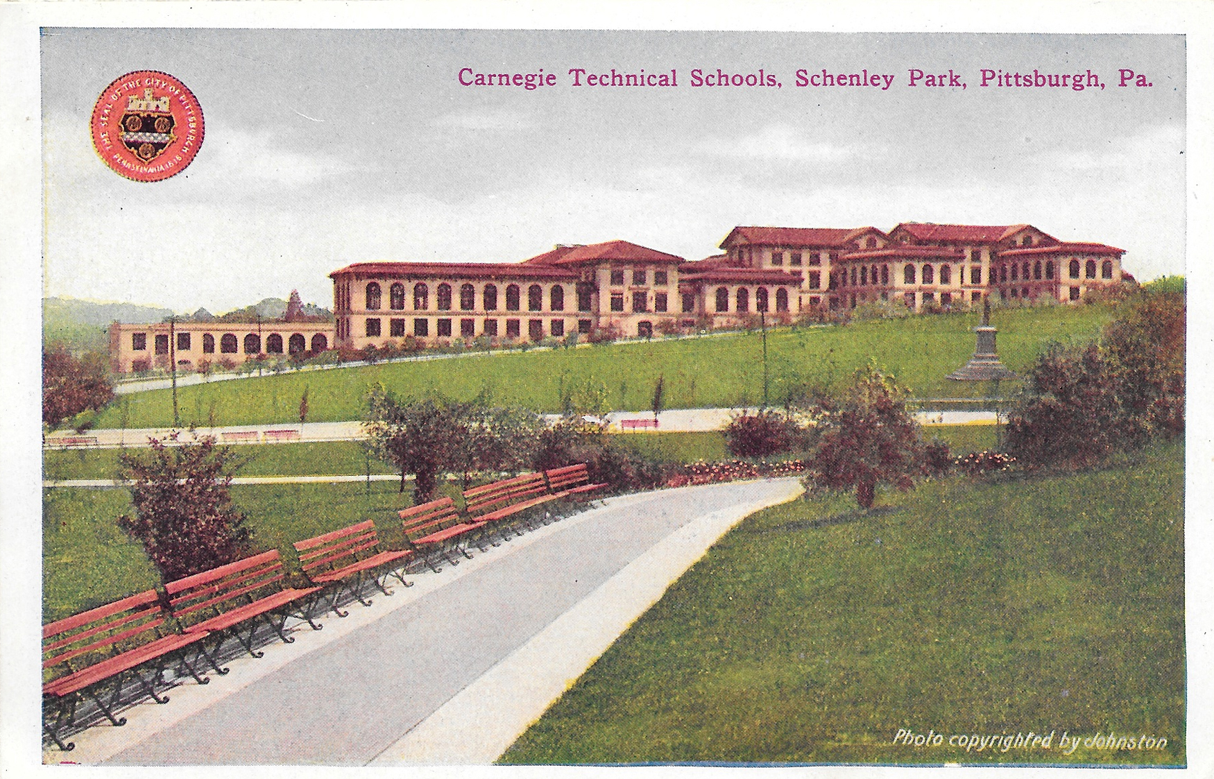
Postcard19-CarnegieTechnicalSchoolsSchenleyPark

Carnegie Technical School, Squirrel Hill (Now Carnegie Mellon University)

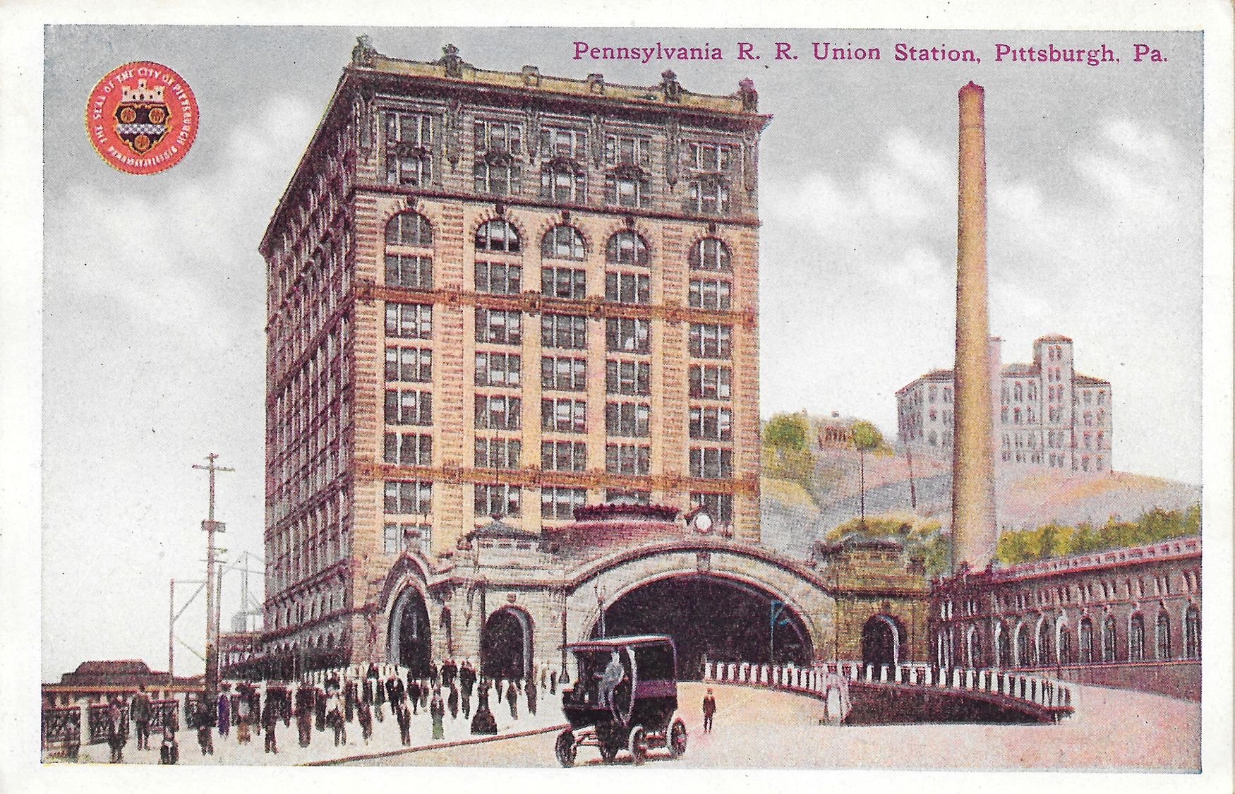
Postcard20-PennsylvaniaRRUnionStation

Pennsylvania Railroad Union Station, Downtown Pittsburgh

Postcard21-HotelSchenley

Hotel Schenley, Oakland (Now the William Pitt Union at the University of Pittsburgh)

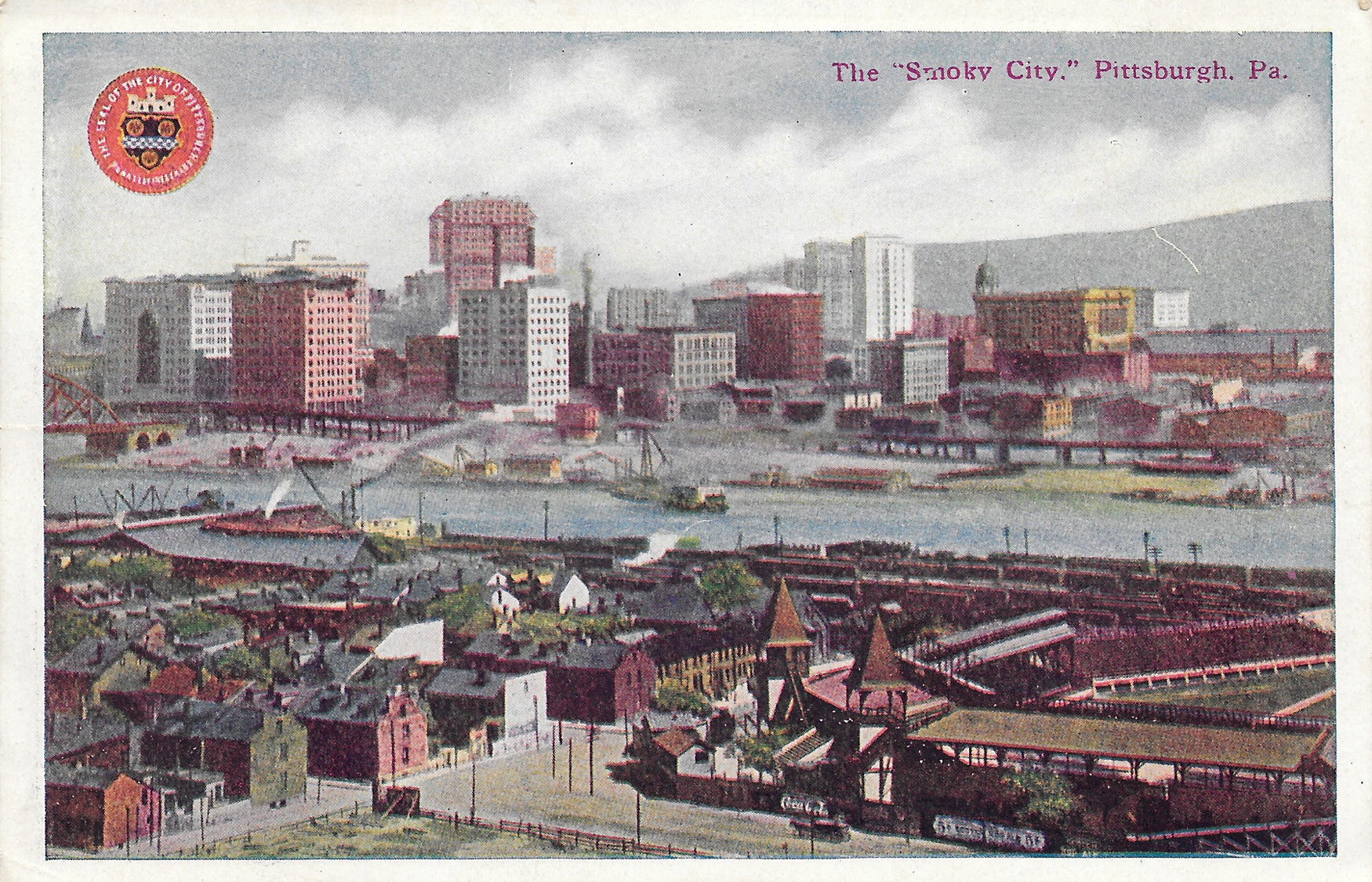
Postcard22-TheSmokyCity

There were a few other ways to confirm this is from 1914.

First, Pittsburgh is spelled with an H on these. From the 1890s until 1911, the city was spelled Pittsburg. Also, there are pictured of Forbes Field and Exposition Park in this collection. There was only a small time frame when both existed at the same time: Forbes Field was built in 1909; Exposition Park (pictured in the "Smoky City" photo) was used until 1915.

It's kind of cool that most of the buildings, with the exception of Forbes Field and the Exposition buildings, are still in existence. Not sure about the fate of the Fort Wayne Depot and Pittsburgh Post Office buildings pictured. Other buildings, while still standing, have changed significantly or have been repurposed. For instance, as I mentioned above, the Schenley Hotel is now the student union building at Pitt. Also, the Allegheny Post Office, in North Side, now houses the Children's Museum of Pittsburgh.

One other thing I did: I searched the name Helen Duncan, of Saltsburg, since this booklet was addressed to her. She was born in September 1904, so she received this booklet right around her 10th birthday. And I'm guessing she held onto it for a long time, or collected them. The seller at Rogers had a few other booklets featuring other cities, so she could've collected them. I didn't see whether they were all addressed to her or not.

Lastly, the booklet had postcard photos on the front and back, instead of the traditional open space to write a note. And they were all attached accordion style. That's something I've never seen before.

Have you ever been curious as to what your hometown looked like 100 years ago? How much have things changed over the last century?